GIS for Electric Utilities: Smarter Network Modelling and Grid Management

Achieving Network-Level Optimisation via implementation of digital energy solutions

solution

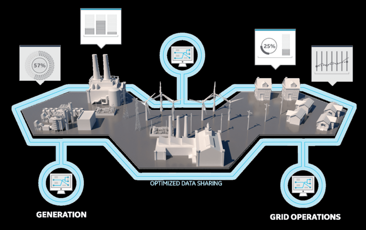
Digital solution that leads to network-level optimization

RedPlanet Solutions GIS electric utility network digital energy ecosystem optimization graphic

By understanding where your network is & how it is connected, you are able to

RedPlanet Solutions GIS electric utility network digital energy ecosystem optimization graphic

benefits

Achieving network-level optimization

We use GIS in electric networks to help you generate more revenue, improve efficiency, and reduce costs by allowing you to see the entire electric grid in one place. It will help you achieve network level optimization by providing you with a detailed analysis of your current energy use and consumption. We’ll also analyze how this impacts your grid and how your grid impacts the environment.

When you use geospatial systems for the electric utility sector, you will be able to see how much energy each part of your network is using at any given time, which will allow you to make informed decisions about where to invest money in upgrading equipment or infrastructure that might be outdated or inefficient.

Besides that, geospatial systems provide real-time data about all aspects of your network, including load balancing and asset management. They can also be used for forecasting future demand based on historical data, which helps you plan for future upgrades or expansions of your infrastructure.


For a deeper look, read our complete guide to GIS for electric utilities and our explainer on geospatial electric network modelling.


RedPlanet Solutions GIS electric utility significant reduction in operational costs OPEX icon

Significant Reduction in OPEX

Enabling high availability of real-time data for critical operations.

RedPlanet Solutions GIS electric grid renewable energy import increase sustainability icon

Increase renewable imports

Significantly increase in the volume of renewable imports onto the grid.

RedPlanet Solutions GIS electric network increased grid capacity asset management

Increased grid capacity

With an overview of all network assets, managing wide area becomes easier.

RedPlanet Solutions GIS electric utility reduce time to action field mobility outage response icon

Reduce Time To Action (short office to field mobility)

Be quick to handle any possible risks of outage with everything within reach.

RedPlanet Solutions GIS electric grid outage planning alternative design solutions

Decrease in outage time (Design, plan alternatives)

Design and plan better and faster for solutions without time on the line.

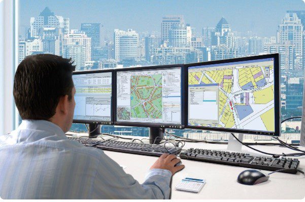
RedPlanet Solutions GIS electric utility operations management planning control room engineers

Improve operation and management

Orchestrate the system from planning through to control.

Powered by

PROUD PARTNER: GE Vernova Smallworld GNM Electric Office

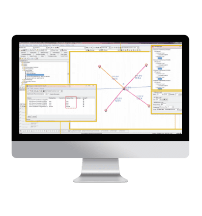
GE Vernova Smallworld GNM Electric Office is a proven, scalable solution with data quality and integrity enforced to support a fully connected, phase aware, network model that is the solid foundation for your grid modernization and network modeling needs.

RedPlanet Solutions GE Smallworld Electric Office GIS network modelling electric utility software screenshot

GE Vernova Smallworld GNM™ Electric Office

GE Vernova Smallworld GNM utility network GIS software partner logo — RedPlanet Solutions authorised partner

Our Proud Partner

General electric digital

Learn more about the software

CASE STUDY RELATED

CASE STUDY

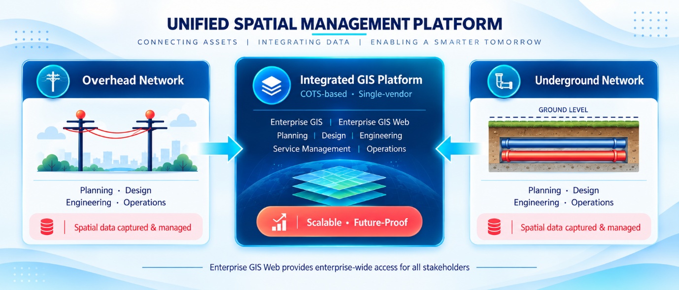
Unified spatial management platform linking overhead and underground networks through an integrated GIS

Integrated GIS Implementation for an Energy and Industrial Organisation in Saudi Arabia

Deploying a unified Integrated GIS environment to manage overhead and underground network operations, supported by enterprise-wide access and a Commercial-Off-The-Shelf approach.
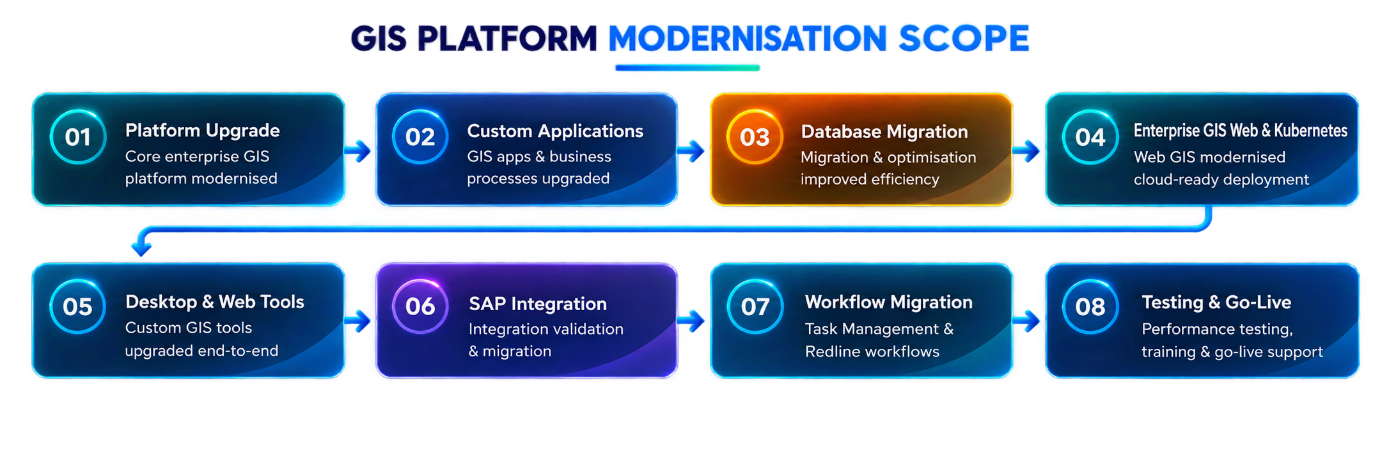
GIS platform modernisation scope: eight workstreams from platform upgrade to testing and go-live

GIS Platform Modernisation for an Electricity Distribution Utility in India

Upgrading an enterprise GIS environment to support electricity distribution network operations, covering platform modernisation, application upgrades, database migration, web GIS, SAP integration and workflow migration.
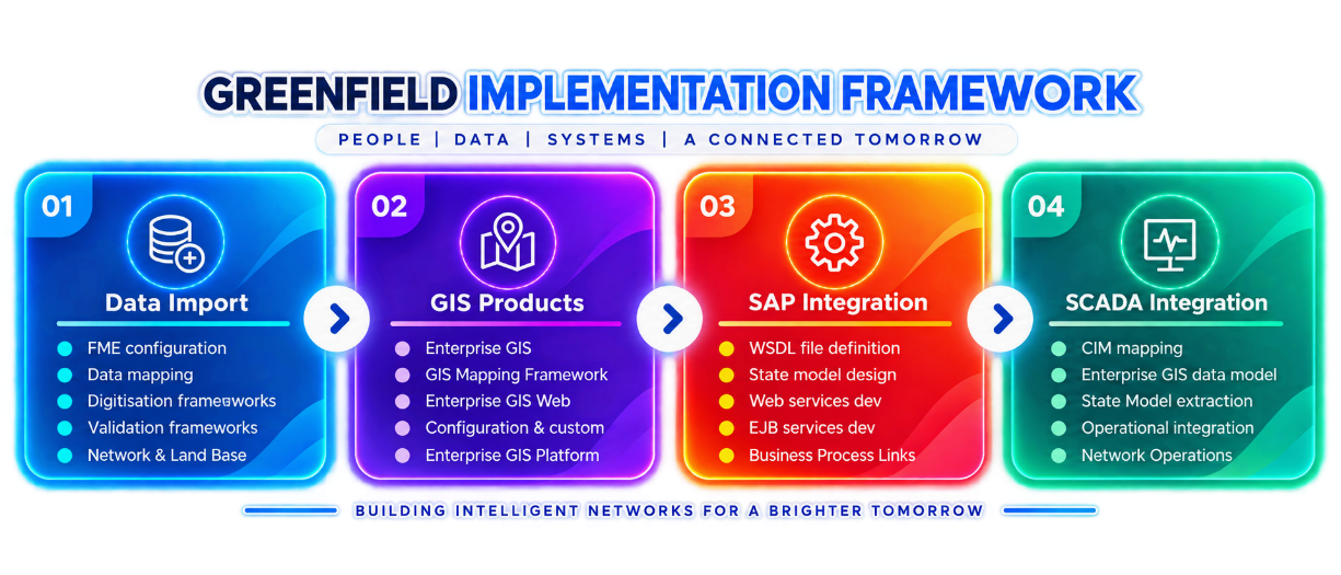
Greenfield EGIS framework: data import, GIS products, SAP integration and SCADA integration

Greenfield EGIS Implementation for an Electric Utility in India

Establishing a Greenfield enterprise GIS environment for electrical network and land base data, supported by enterprise GIS product implementation, SAP integration and SCADA integration.
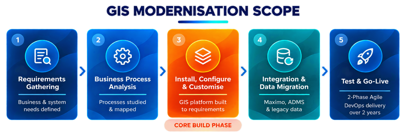
GIS modernisation scope in five phases, from requirements gathering to test and go-live

Enterprise GIS Modernisation for an Electric Utility in the Philippines

Replacing a legacy GIS environment with a modern enterprise GIS solution, supported by enterprise integration, data migration and phased Agile delivery.
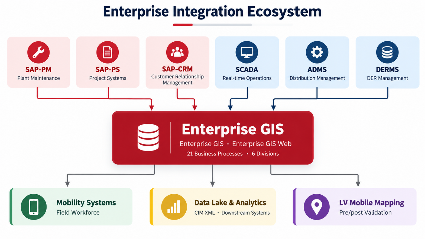
Enterprise GIS integration ecosystem connecting SAP, SCADA, ADMS, DERMS, mobility and analytics systems

Enterprise GIS Transformation for a Leading Electric Company in Malaysia

A long-term enterprise GIS programme covering system upgrades, business process integration, data governance, network data migration, technical support and system optimisation.

Speak to us today!

Explore how GIS can help your organization solve industrial challenges. We expand more potential on your industrial data that you have within your reach.