Spatial Eye Solutions

Spatial Eye is a comprehensive geospatial platform designed to connect planning, operations, and data intelligence into a unified ecosystem. Built for organisations managing complex network infrastructures, Spatial Eye transforms disconnected data into a single environment for faster, data-driven decisions.
SE NetPlan lets organisations design, simulate, and optimise future network scenarios. It supports the entire planning lifecycle, allowing teams to move seamlessly from early-stage visioning to detailed design and validation.

OVERVIEW

What Is Spatial Intelligence, and Why Does Network Management Need It?

Through RedPlanet’s partnership with Spatial Eye, organisations gain access to advanced tools for network planning, real-time connectivity analysis, and enterprise-wide spatial intelligence. The platform enables seamless collaboration across teams, keeping planning and operations connected in one workspace.

Spatial Eye delivers a suite of five integrated GIS products: SE NetPlan, SE NetCon, SE Warehouse, SE Workshop, and SE Lite. Together, these cover the full spectrum of network planning, connectivity analysis, and spatial data management for utilities, telecommunications providers, and smart city organisations. As an authorised Spatial Eye implementation partner, RedPlanet Solutions deploys and configures the platform across Malaysia, Southeast Asia, India, New Zealand, and the broader APAC region.

Spatial intelligence is the capability to collect, integrate, analyse, and act on location-based data to understand how physical assets, networks, and environments behave over space and time. For network operators managing electric grids, gas pipelines, water distribution systems, or fibre and telecom infrastructure, spatial intelligence is the foundation of every planning decision. From where to build new capacity to how to respond when something fails.

Traditional GIS tools provide maps and spatial queries, but spatial intelligence goes further. It connects network topology with live operational data, historical records, and forward-looking simulations. This gives organisations the ability to understand not just where their assets are, but how they interact, behave under load, and change over time.

A purpose-built spatial intelligence platform for network management enables organisations to:

  • Plan, simulate, and validate future network designs before committing capital
  • Analyse real-time connectivity and identify gaps or inconsistencies across live infrastructure
  • Consolidate spatial and enterprise data from disparate systems into a single, governed repository
  • Perform advanced geospatial analysis to support asset management and investment decisions
  • Deliver spatial data access to all users, from field engineers to senior leadership, through web and desktop interfaces

About Spatial Eye

Spatial Intelligence Platform: Planning, Connectivity and Data Management

Spatial Eye brings together multiple capabilities into one cohesive platform, enabling organisations to manage the full lifecycle of their network and data. Instead of working across fragmented tools and siloed systems, users operate within a unified environment where data flows seamlessly and insights are always accessible.

The platform supports everything from long-term planning and simulation to real-time analysis and reporting. By combining geospatial intelligence with advanced data modelling, Spatial Eye allows organisations to understand not just what their assets are, but how they perform and change over time.

As a Spatial Eye partner, RedPlanet Solutions delivers tailored implementations that align with your operational goals. From initial design to full-scale deployment, we ensure the platform is configured for your workflows.

The platform is purpose-built for organisations operating complex physical networks. This includes electric utilities, gas distribution companies, water and wastewater operators, and telecommunications providers. It addresses the core challenge these organisations share: managing large volumes of spatially distributed asset data that must remain accurate, consistent, and accessible across multiple teams, systems, and regulatory reporting requirements.

The Spatial Eye Product Suite

SE NetPlan lets organisations design, simulate, and optimise future network scenarios. It supports the entire planning lifecycle, allowing teams to move seamlessly from early-stage visioning to detailed design and validation.

SE NetPlan: Network Planning and Simulation

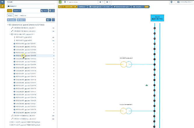
SE NetPlan lets organisations design, simulate, and optimise future network scenarios. It supports the entire planning lifecycle, allowing teams to move seamlessly from early-stage visioning to detailed design and validation.

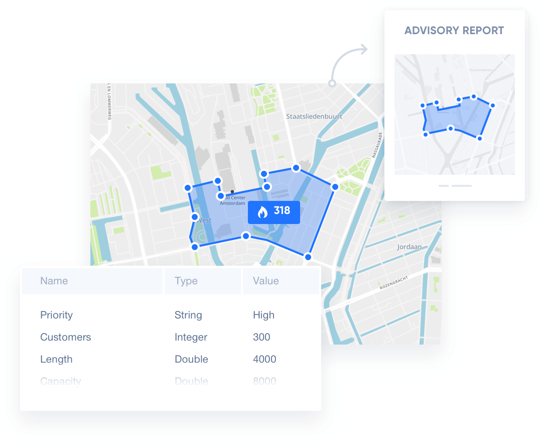
With advanced modelling capabilities, SE NetPlan allows users to visualise future scenarios, assess risks, and evaluate investment strategies within a collaborative workspace. By integrating planning workflows into a single system, it reduces complexity, improves coordination, and accelerates decision-making.

  • Visualise future network scenarios
  • Model risks, capacity, and investment strategies
  • Enable collaborative planning across teams
  • Build and manage digital representations of networks

SE NetPlan functions as the network planning and simulation software layer of the Spatial Eye ecosystem. It enables network engineers and planners to build digital twin representations of their physical network. It also tests proposed changes, capacity expansions, and investment scenarios in a controlled simulation environment before any physical work begins. For utilities and telecoms planning capital programmes, this reduces the risk of costly design errors and gives decision-makers confidence that plans are technically and commercially sound.

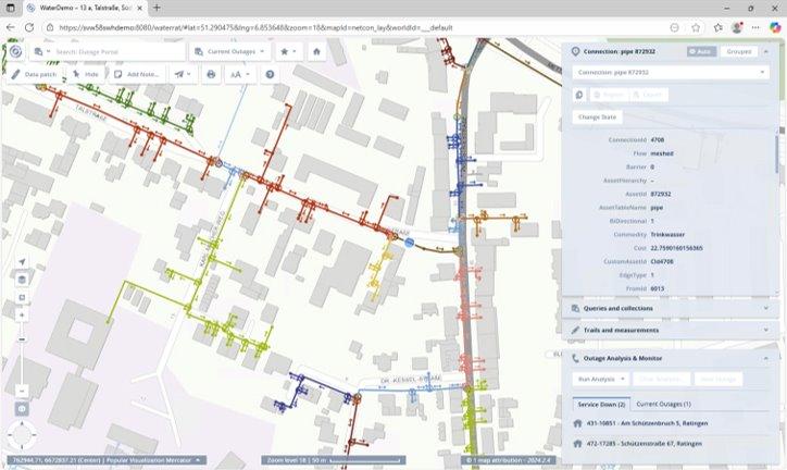
SE NetCon is a high-performance connectivity engine that transforms static network data into a dynamic, real-time model. It provides instant insights into how networks are connected and how they behave under different conditions.

SE NetCon: Real-Time Connectivity Analysis

SE NetCon is a high-performance connectivity engine that transforms static network data into a dynamic, real-time model. It provides instant insights into how networks are connected and how they behave under different conditions.

By enabling real-time tracing and analysis, SE NetCon helps organisations identify connectivity gaps, improve data quality, and respond quickly to operational challenges. Its in-memory architecture ensures that even complex analyses are delivered instantly.

  • Real-time upstream and downstream tracing
  • Detect connectivity gaps and inconsistencies
  • Analyse network behaviour dynamically
  • Support rapid operational decision-making

SE NetCon's in-memory architecture is what separates it from conventional GIS network analysis tools. Rather than running queries against a database (which introduces latency for complex network traces), SE NetCon holds the entire network model in memory, delivering upstream and downstream tracing results for even large, complex networks in seconds. This speed is critical in operational scenarios such as fault isolation, planned outage management, and emergency response, where decisions cannot wait for batch processing.

SE Warehouse acts as the central data foundation of the Spatial Eye ecosystem, bringing together spatial and enterprise data into a unified, trusted repository.

SE Warehouse: Centralised Spatial Data Management

SE Warehouse acts as the central data foundation of the Spatial Eye ecosystem, bringing together spatial and enterprise data into a unified, trusted repository.

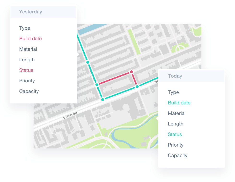
It integrates data from multiple sources, transforms it into structured formats, and enables time-based analysis. By maintaining historical data and tracking changes over time, SE Warehouse supports better forecasting, reporting, and strategic planning.

  • Integrate spatial and non-spatial data from multiple sources
  • Enable time-based insights across past and current states
  • Maintain complete data lineage and change tracking
  • Deliver analytics-ready data for business applications

SE Warehouse handles the GIS data integration challenge that most network operators face: bringing together asset records from field surveys, SCADA systems, work order management platforms, and historical datasets into a single, time-stamped, analytically consistent repository. Complete data lineage means every change to the network record is tracked, auditable, and reversible. This meets the compliance and governance requirements of regulated utility and government organisations.

SE Workshop is a powerful GIS desktop application designed for advanced spatial analysis and data transformation. It provides an interactive environment where users can explore, analyse, and manage complex datasets with ease.

SE Workshop: Advanced GIS Desktop Application

SE Workshop is a powerful GIS desktop application designed for advanced spatial analysis and data transformation. It provides an interactive environment where users can explore, analyse, and manage complex datasets with ease.

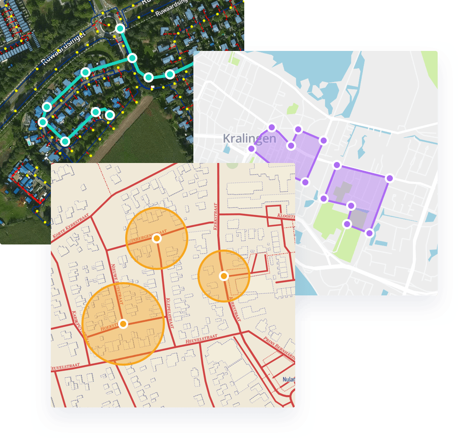
By combining spatial, non-spatial, and network data into a single interface, SE Workshop enables more detailed analysis and faster decisions. It also supports data preparation and transformation, ensuring that datasets are always ready for analysis.

  • Visualise and analyse spatial and network data
  • Perform advanced GIS operations and modelling
  • Transform and prepare datasets efficiently
  • Support enterprise-level decision-making

SE Workshop operates as the power-user GIS environment within the Spatial Eye suite. Where SE Lite provides broad, simplified access for all users, SE Workshop delivers the advanced spatial analysis, topology editing, and data transformation capabilities that GIS analysts, network engineers, and data managers need for complex tasks. It complements open-source tools like QGIS while providing the tight integration with SE NetPlan, SE NetCon, and SE Warehouse that standalone desktop GIS applications cannot offer.

SE Lite is a browser-based application that makes geospatial data accessible across the organisation. It allows users to interact with maps, run queries, and generate reports without requiring specialised software.

SE Lite: Browser-Based Spatial Data Access

SE Lite is a browser-based application that makes geospatial data accessible across the organisation. It allows users to interact with maps, run queries, and generate reports without requiring specialised software.

Designed for ease of use, SE Lite makes spatial data available to everyone in the organisation

  • Access maps and data through a web interface
  • Run queries and generate reports instantly
  • Explore layers and asset information easily
  • No installation required

SE Lite is the access layer that makes the Spatial Eye ecosystem usable across the entire organisation, not just the GIS team. Any user with a web browser can access current network data, run location-based queries, and generate reports directly from the live spatial model. This extends the value of the platform beyond technical users to operations teams, management, customer service, and regulatory reporting functions, all accessing the same, current, single version of network truth.

Core Capabilities

What Spatial Eye Enables

  • Integrated Network Planning: Design, simulate, and optimise future network scenarios within a unified environment that connects strategy with execution.
  • Real-Time Connectivity Intelligence: Understand how networks behave in real time with dynamic tracing, analysis, and instant insights.
  • Centralised Data Management: Bring together spatial and enterprise data into a single source of truth, eliminating silos and inconsistencies.
  • Advanced Geospatial Analysis: Perform in-depth analysis using powerful GIS tools that uncover patterns, relationships, and insights.
  • Enterprise-Wide Accessibility: Enable access to spatial data across all user levels through intuitive web and desktop applications.
  • Scalable Platform Architecture: Adapt and expand the platform as your organisation grows, supporting evolving business needs.

These capabilities position Spatial Eye as a comprehensive GIS asset management platform for organisations that need more than a static data viewer.

Industries That Use Spatial Eye

Spatial Eye is deployed across sectors where managing complex, geographically distributed networks is central to operations:

  • Electric Utilities: Network planning and connectivity analysis for transmission and distribution grids, from capacity planning and fault simulation to regulatory reporting and digital twin creation.
  • Gas Networks: Pressure zone management, pipeline connectivity analysis, and as-built data management for gas distribution and transmission operators.
  • Water and Wastewater: Hydraulic network modelling data integration, asset lifecycle tracking, and condition-based maintenance planning for water distribution and sewerage networks.
  • Telecommunications and Fibre: End-to-end fibre and telecoms network planning, inventory management, and connectivity analysis for fixed and mobile network operators.
  • Smart Cities and Local Government: Cross-department infrastructure data integration, urban planning support, and public utility asset management for city authorities and government agencies.

Why Spatial Eye

Unlike general-purpose GIS platforms such as Esri ArcGIS or QGIS, Spatial Eye is built specifically for network-centric organisations. It comes with native support for network topology, connectivity modelling, and data lineage out of the box. This focused design means significantly less configuration, fewer custom development requirements, and faster time-to-value for utilities, telecoms operators, and government agencies managing critical infrastructure.

  • Unified platform for planning, analysis, and operations
  • Seamless integration of spatial and enterprise data
  • Real-time insights for faster decision-making
  • Scalable and flexible architecture
  • Designed for complex network environments
  • Delivered with RedPlanet’s implementation expertise

Our Partnership

Spatial Eye . Redplanet

Where RedPlanet Expertise Meets Spatial Eye Innovation

As a trusted Spatial Eye partner, RedPlanet Solutions brings deep domain expertise and hands-on implementation experience to every engagement. We work closely with your team to understand your data landscape, operational workflows, and business objectives, ensuring that Spatial Eye is configured to fit your operations.

Our services cover the full lifecycle from discovery and solution design to deployment and optimisation. We ensure that every component of the platform is aligned with your needs, delivering a solution that scales with your operations.

Beyond implementation, RedPlanet provides ongoing support, training, and advisory services to help your organisation get the most out of Spatial Eye.

RedPlanet’s Spatial Eye implementation services operate across Malaysia, India, New Zealand, and the broader APAC region. Our teams have deep experience in utility network GIS, telecoms network inventory, and smart city spatial data infrastructure. This ensures that Spatial Eye is integrated correctly with the systems your organisation already runs, including GE Vernova Smallworld, FME data pipelines, Hexagon platforms, and custom GIS environments.

Frequently Asked Questions

Spatial Eye is a geospatial network intelligence platform built for organisations managing complex network infrastructure — including utilities (electric, gas, water), telecommunications, and smart city operations. It provides five integrated products: SE NetPlan for network planning and simulation, SE NetCon for real-time connectivity analysis, SE Warehouse for spatial data management, SE Workshop for advanced GIS analysis, and SE Lite for browser-based data access.

Spatial intelligence in network management is the ability to collect, integrate, and analyse location-based asset and operational data to understand how networks behave over space and time. It goes beyond mapping to connect network topology with live data, historical records, and forward-looking simulations, enabling planners, engineers, and operational teams to make faster, more confident decisions about complex physical infrastructure.

SE NetPlan is used for network planning and simulation. It enables utility and telecoms organisations to design future network scenarios, model capacity and investment options, assess risks, and validate designs within a collaborative digital environment. It functions as the network planning software layer of the Spatial Eye platform, allowing teams to test proposed changes before committing to capital expenditure.

SE NetCon is a real-time network connectivity analysis engine that uses an in-memory architecture to deliver instant upstream and downstream network tracing. Rather than querying a database, it holds the entire network model in memory, enabling complex connectivity analyses to be completed in seconds. It is used for fault isolation, planned outage management, data quality validation, and operational decision-making.

Spatial Eye is used primarily by electric utilities, gas network operators, water and wastewater companies, telecommunications and fibre providers, and smart city government agencies. Any organisation managing complex, geographically distributed network infrastructure that requires planning, connectivity analysis, and data management in an integrated GIS environment is a candidate for the Spatial Eye platform.

As an authorised Spatial Eye partner, RedPlanet Solutions provides end-to-end implementation services: discovery and requirements analysis, solution design and configuration, full deployment of SE NetPlan, SE NetCon, SE Warehouse, SE Workshop, and SE Lite, staff training, and ongoing support. RedPlanet operates across Malaysia, India, New Zealand, and the APAC region, with domain expertise in utilities, telecoms, and smart city GIS.

Spatial Eye is purpose-built for network-centric organisations, with native network topology support, connectivity modelling, and data lineage built in. General GIS platforms like Esri ArcGIS are horizontal tools requiring significant customisation to support network management workflows. Spatial Eye reduces that configuration overhead and delivers network-specific capabilities (real-time tracing, simulation, and data warehousing), out of the box, faster and with less specialist development effort.

Ready to See Spatial Eye in Action?

Talk to a RedPlanet specialist about your network data challenges and discover which Spatial Eye products are the right fit for your organisation.

Whether you need to improve network planning accuracy, bring real-time connectivity analysis to your operations team, or consolidate fragmented spatial and enterprise data into a single governed platform, our team will assess your current environment and recommend the right combination of Spatial Eye products and implementation approach.

RedPlanet’s Spatial Eye advisory and implementation services cover Malaysia, India, New Zealand, and the APAC region. Our team is ready to demonstrate the platform, discuss your network management challenges, and scope a deployment that delivers measurable value from day one.

Speak to us today!

Explore how RedPlanet can help your organisation solve its data challenges. Speak to our team today.