FME — Connect Everything. Automate Anything.

As a trusted FME solutions provider, we help organizations turn complex, siloed data into accessible, actionable information. Whether you need to integrate spatial and non-spatial data, automate recurring workflows, migrate legacy systems, or build custom data pipelines, our team of FME specialists delivers tailored integration solutions that save time, reduce errors, and scale with your business.
GIS & spatial Databases IoT & real-time FMEtransform & automate Cloud Enterprise apps Analytics
Sources
GIS & spatial
Databases
IoT & real-time
FMEtransform & automate
Destinations
Cloud
Enterprise apps
Analytics
image1

OVERVIEW

What Is FME?

FME is a data integration and ETL platform that connects, transforms, and automates data across different systems, formats, and environments. As an authorised FME partner, RedPlanet Solutions helps organisations implement automated data workflows across GIS, utilities, infrastructure, smart cities, and enterprise systems.

Whether your organisation needs enterprise data integration software to connect GIS and operational systems, an ETL platform to automate complex data pipelines, or an experienced FME implementation partner, RedPlanet Solutions can help. Our team brings geospatial expertise and hands-on implementation experience to design, deploy, and manage FME workflows across complex data environments.

FME (Feature Manipulation Engine), developed by Safe Software, is a no-code data integration platform used to move, transform, validate, and automate data between different systems and formats. It natively supports spatial data (vector, raster, point cloud), structured databases, cloud services, real-time streams, and legacy systems.

RedPlanet Solutions, an authorised FME partner, implements FME for clients across utilities, smart cities, infrastructure, agriculture, and enterprise. We deliver automated and scalable data integration workflows aligned with business objectives.

FME enables organisations to:

  • Connect data across spatial systems, databases, cloud platforms, streaming services, and legacy environments
  • Build no-code ETL workflows through a visual interface
  • Deploy automated data pipelines that run on schedule, respond to events, or serve AI agents
  • Process geospatial data natively, including reprojection, validation, and spatial data transformation
  • Integrate enterprise systems with AI models through FME’s MCP-compatible API layer

ABOUT FME

FME Solutions Offering — Data Integration & ETL

FME (Feature Manipulation Engine) is designed to integrate and transform data across different systems and environments. Whether working with spatial data, real-time streams, structured databases, cloud applications, or legacy systems, FME simplifies data movement and transformation workflows.

It provides a unified approach to data integration, helping information move seamlessly between systems without manual intervention. FME also helps organisations maintain data quality, improve operational efficiency, and automate repetitive data handling processes.

RedPlanet works closely with organisations to understand their data landscape, define integration strategies, and implement workflows aligned with business objectives.

FME, developed by Safe Software and deployed globally across thousands of organisations, supports over 500 data formats and systems. This includes all major GIS platforms (Esri ArcGIS, QGIS, GE Smallworld), spatial databases (PostGIS, Oracle Spatial, SQL Server), cloud services (AWS, Azure, Google Cloud), and enterprise applications (SAP, Salesforce, Microsoft 365). This broad format support makes FME well suited for organisations managing complex environments where spatial and operational data need to work together.

THE PLATFORM

FME Applications

image1
fme-feature-manipulation-engine-workflow-overview.jpg

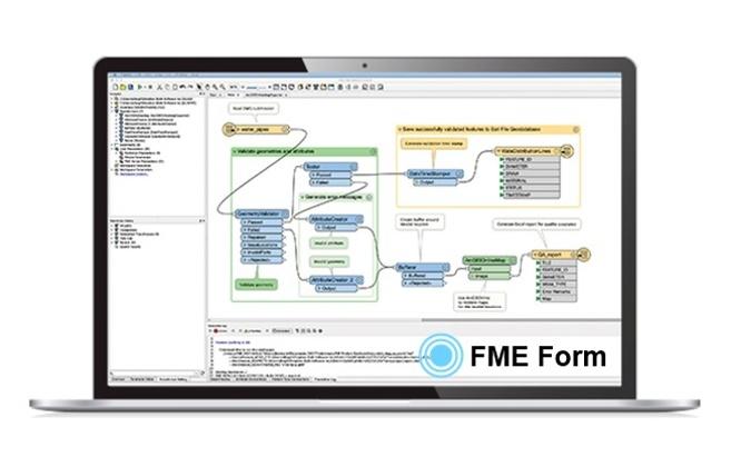
FME Form

FME Form is the no-code authoring environment used to design, test, and manage data integration workflows through a visual interface.

Teams can build transformation pipelines without writing code using pre-built transformers for geometry processing, data cleansing, format conversion, and attribute management. FME Form also supports step-by-step data inspection, allowing users to review and validate data before deployment. Features such as workspace comparison, authoring assistance, and undo history help teams manage workflow development more efficiently.

Unlike traditional ETL tools that rely on scripting or SQL, FME Form allows GIS professionals, analysts, and integration teams to build and maintain workflows through a visual workflow environment.

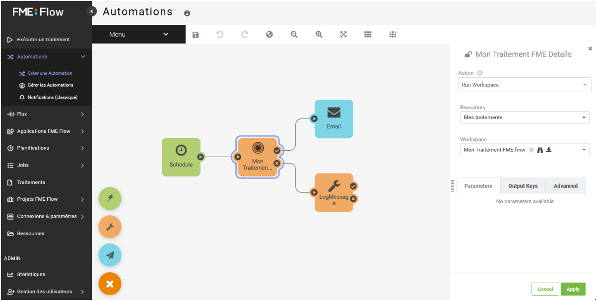
FME Flow

FME Flow is the deployment and automation platform used to run FME workflows in production environments.

Teams can use FME Flow to schedule workflows, trigger automations from events, process real-time data streams, and manage data delivery across connected systems. The platform also supports self-service web applications and API-based integrations for operational workflows.

Previously known as FME Server, FME Flow provides a centralised environment for workflow automation, monitoring, validation, and processing. It also supports MCP-compatible integrations, allowing AI systems and applications to securely interact with governed enterprise and geospatial data through existing FME workflows.

CORE CAPABILITIES

What FME Enables

Data Integration & ETL

FME is a complete data integration and ETL platform that supports every data movement pattern an enterprise stack throws at it: bulk batch loads from source to destination, incremental change sync, bidirectional replication between analytics and operational systems, and event-driven real-time flows that remove the need for replication altogether.

These ETL patterns run across structured databases, spatial systems, file formats, cloud APIs, and legacy applications. For organisations managing multi-source data environments where spatial, operational, and enterprise data must move together, FME consolidates what would otherwise be a stack of point integrations into a single data integration platform.

No-Code Web Applications

FME Flow lets users publish no-code self-serve web applications directly from existing workflows, no development sprint required. Field crews submit data, operations teams trigger integrations, and business analysts retrieve results through a simple browser interface.

These no-code web apps shift routine data operations out of the IT queue. Field submissions, validation runs, and ad-hoc data requests get faster turnaround, and the outputs feed directly into your GIS and enterprise systems without manual handoffs.

Geospatial Data Processing

FME natively handles every common spatial format (Vector, Raster, Point Clouds, Data Cubes, and more), which is why it remains the default geospatial ETL choice for GIS environments.

A single FME workflow performs coordinate system reprojection, geometry validation, spatial joins, topology repair, and format conversion. It supports Esri ArcGIS, QGIS, GE Smallworld, PostGIS, and every major GIS platform. For teams managing spatial and enterprise data together, FME geospatial data processing removes the manual conversion and re-formatting that quietly eats analyst time.

AI-Powered Enterprise Integration

FME workflows can be exposed as MCP-compatible AI-ready tools, so AI agents and large language models securely access enterprise and geospatial data through governed FME pipelines. There is no lock-in to any single model vendor.

This positions FME as the data access layer for enterprise AI deployments. Organisations build AI data pipelines from existing integration logic and reuse them across AI-driven automation, analytics, and operational workflows. Pipelines stay auditable, reusable across multiple AI applications, and independent of any single model.

Real-Time & IoT Streaming

FME’s real-time data integration continuously processes live streams with minimal latency, handling high-velocity input from IoT sensors, transactional systems, and event-driven sources as it arrives.

For utilities managing electric grids, water networks, or gas pipelines, where the operational picture changes by the second, FME’s real-time streaming keeps GIS asset records, control systems, and field applications aligned to the current state of the network. No manual updates. No batch-processing lag.

Flexible Deployment

FME runs natively on Windows, Linux, and Mac, on both Intel and ARM processors. Deploy on-premises with FME Flow, in the cloud with FME Cloud, or as a hybrid deployment that matches your data residency, security, and performance constraints.

Government and utility clients with strict data sovereignty requirements typically run on-premises FME Flow. Organisations that prioritise elastic scale use FME Cloud, which delivers capacity on demand across AWS, Azure, and Google Cloud without the hardware overhead.

SOLUTIONS BY INDUSTRY

FME Across Industries

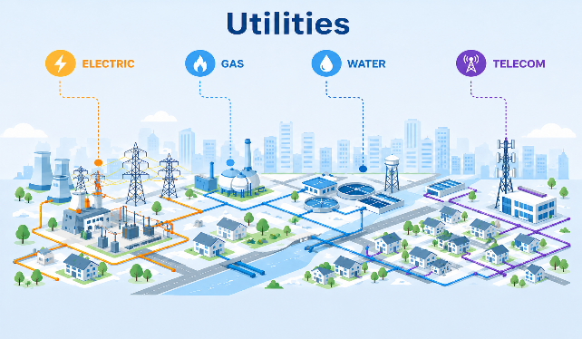
fme-utilities-gis-data-integration-electric-gas-water.jpg

Utilities & Network Management

FME is the data integration backbone for utility network management, synchronising asset data across GIS, SCADA, work order management, and customer information systems. FME keeps electric, gas, water, and telecom network records current and consistent. This eliminates manual data handling and reducing errors that disrupt service operations.

For utilities, FME is the data integration backbone connecting field-captured asset data to SCADA, CIS, and work order systems. Ensuring real-time synchronisation across the full network management stack without manual data handling.

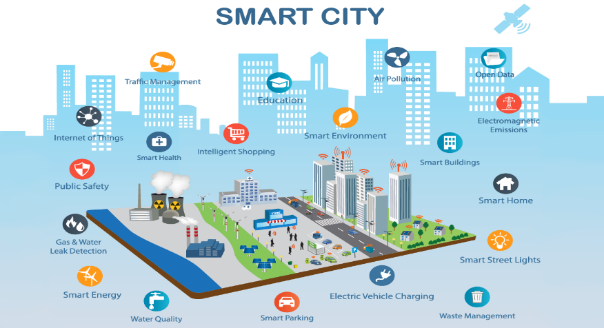
Smart City & Government

FME unifies spatial and operational data from multiple civic departments into a single, accessible platform for smart city and government use. Automate permit processing workflows, infrastructure condition updates, and public service data delivery. This enables governments to make faster, evidence-based decisions that improve outcomes for communities.

FME connects cross-department data streams (transport, utilities, land use, environmental monitoring) into unified spatial platforms that support digital twin creation, evidence-based planning, and real-time operational dashboards across the organisation.

Precision Agriculture

FME combines drone imagery, IoT sensor feeds, satellite data, and field survey inputs into automated precision agriculture workflows that agronomists and farm managers can actually use. Multispectral drone surveys, soil moisture sensors, weather feeds, and satellite imagery flow through a single pipeline.

The outputs are the artefacts the field actually wants: NDVI maps for crop health, variable-rate irrigation recommendations, yield forecasts, and compliance reports. FME delivers them straight into the agronomy platforms, farm management systems, and dashboards teams already rely on, so insights inform decisions before the growing window closes.

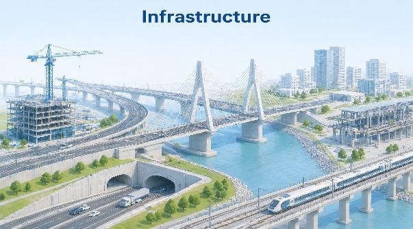
fme-bim-gis-integration-infrastructure-digital-twin.png

Infrastructure & BIM

FME closes the gap between CAD, BIM, and GIS environments. Engineering models and design data move into spatial workflows that support asset management, Digital Twin creation, and lifecycle monitoring, so project teams work from the same information no matter which tool they prefer.

BIM-GIS integration via FME bridges IFC, Revit, and CAD engineering models with ArcGIS, QGIS, and digital twin platforms. Asset managers query and analyse infrastructure data across the full project lifecycle, from design through construction handover and into decades of operations.

fme-transportation-logistics-real-time-fleet-route-data-integration.jpg

Transportation & Logistics

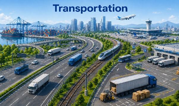
Stream and integrate real-time fleet, route, and logistics data across platforms and systems. FME enables transportation operators to build location-aware workflows that improve mobility, optimise delivery routes, reduce delays, and ensure that operational data is always synchronised across the systems that depend on it.

fme-defence-emergency-management-sensor-spatial-data-integration.jpg

Defence & Emergency Management

FME is the data integration layer for defence and emergency management, fusing live sensor feeds, ISR data, and command system telemetry into a single common operating picture. Mission planning, multi-agency incident response, and after-action review all run from the same authoritative data, so decisions made under pressure rest on a current operational picture, not a brief.

Why FME

  • No-Code Workflow Authoring
  • Seamless Geospatial & Enterprise Integration
  • Real-Time & Event-Driven Automation
  • AI-Ready Data Pipelines
  • Cloud, On-Premises & Hybrid Deployment
  • Scalable to Any Data Volume
  • Supported by RedPlanet’s Local Expertise

Most ETL tools stop at structured data. FME goes further, with native geospatial processing, a visual no-code authoring environment, over 500 built-in format connectors, and a global community transformer library that covers everything from spatial point clouds to enterprise relational databases.

OUR PARTNERSHIP

RedPlanet as Your FME Partner

As an authorised FME partner, RedPlanet Solutions brings deep geospatial expertise and hands-on implementation experience to every FME engagement. We work closely with your team to understand your data landscape (where it lives, where it needs to go, and how it needs to be transformed), and we design FME workflows that deliver reliable, automated results aligned to your business objectives.

RedPlanet’s FME services span the full project lifecycle, from initial discovery and requirements analysis, through workflow design in FME Form, to enterprise deployment via FME Flow. Our team tests and validates at every stage, ensuring workflows are functional, resilient, and ready to scale as your organisation grows.

Beyond implementation, RedPlanet provides ongoing support, training, and advisory services to ensure your team gets the most from FME over time. Whether onboarding new users, optimising existing workflows, or expanding to new data sources and systems, our consultants are available to guide you at every stage.

RedPlanet’s data integration consulting and FME implementation services operate across Malaysia, India, New Zealand, and the broader APAC region, delivering local expertise alongside global best practice. From initial architecture design to post-deployment training and workflow optimisation, our team ensures your FME investment delivers lasting, measurable value.

Frequently Asked Questions

FME (Feature Manipulation Engine) is used to integrate, transform, and automate data between any source and destination — including GIS platforms, databases, cloud applications, IoT sensors, and legacy systems. It is widely used for geospatial data integration, enterprise ETL workflows, real-time data streaming, AI data pipelines, and no-code self-serve data applications across utilities, smart cities, infrastructure, and government sectors.

FME Form is the no-code desktop authoring environment where data integration workflows are designed and tested. FME Flow is the enterprise deployment platform where workflows are published, scheduled, triggered by events, and exposed to users as automated services or self-serve web applications — enabling organisation-wide data automation at scale.

Yes. FME Form provides a fully visual, no-code authoring environment where data integration and ETL workflows are built using pre-built transformers — without writing code. This makes it accessible to GIS professionals, data analysts, and business users while remaining powerful enough for complex enterprise data pipelines.

FME supports all major GIS platforms including Esri ArcGIS, QGIS, GE Vernova Smallworld, Hexagon Geospatial, PostGIS, Oracle Spatial, SQL Server Spatial, and MapInfo — along with OGC-standard formats (WFS, WMS, GML, GeoJSON) and over 500 other data formats. This makes it the leading geospatial ETL and data integration tool for GIS environments.

Yes. FME Flow exposes any workflow as an MCP-compatible AI-ready tool, allowing AI agents and large language models to securely access and transform enterprise data through governed FME pipelines. This creates reliable AI data pipelines without rebuilding existing integration logic or compromising data governance and security.

As an authorised FME partner, RedPlanet Solutions provides end-to-end FME services: discovery and requirements analysis, workflow design in FME Form, enterprise deployment via FME Flow, quality assurance, training, and ongoing support. RedPlanet brings deep geospatial expertise across utilities, smart cities, infrastructure, and agriculture — operating across Malaysia, India, New Zealand, and the APAC region. Explore how FME and RedPlanet can transform the way your organisation integrates, automates, and acts on its data. Our team is ready to help you build workflows that work. Whether you are new to FME, looking to expand an existing deployment, or need a local authorised FME partner with deep geospatial expertise — contact RedPlanet Solutions to discuss your data integration requirements.

Ready to Bring Life to Your Data?

Explore how RedPlanet can help your organisation solve its data challenges. Speak to our team today.