Deploying a unified Integrated GIS environment to manage overhead and underground network operations, supported by enterprise-wide access and a Commercial-Off-The-Shelf approach.
| Location | Solution | Networks | Approach |
|---|---|---|---|
| Saudi Arabia | Integrated GIS | Overhead & Underground | COTS-based |
Overview
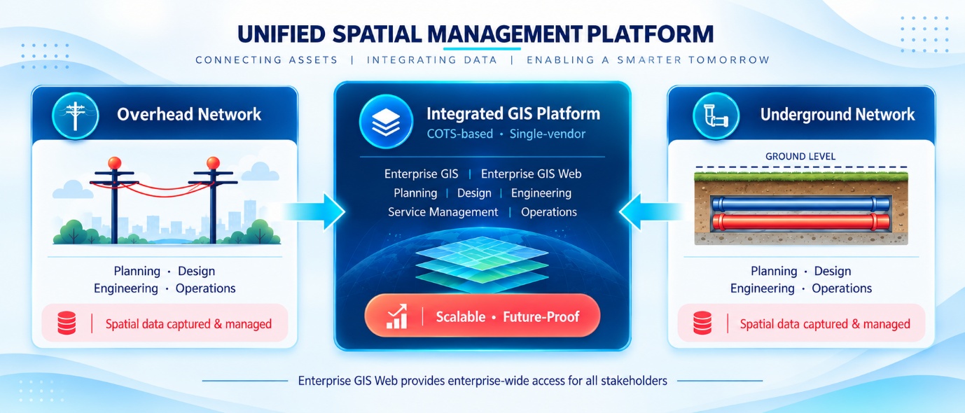
An energy and industrial organisation in Saudi Arabia required an Integrated Geographic Information System (GIS) environment to unify spatial data across both overhead and underground network infrastructure. The organisation manages large-scale energy and industrial operations, with a GIS requirement spanning the full network lifecycle — from initial planning and engineering design through to service management and day-to-day network operations.
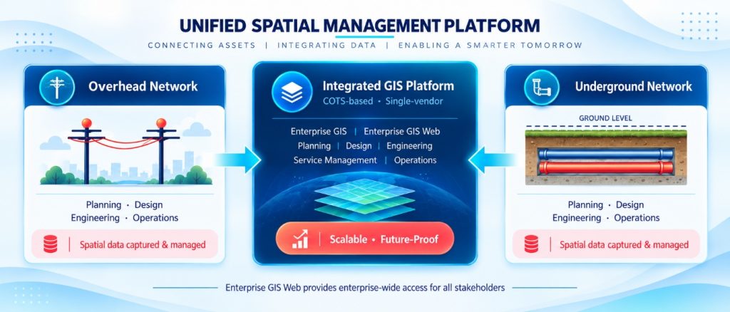
RedPlanet Solutions implemented an Integrated GIS solution using a Commercial-Off-The-Shelf (COTS) approach, deploying proven enterprise GIS technology to avoid the overhead and risk associated with a fully custom-built solution. The platform was designed to support a broad range of network infrastructure activities within a single, integrated spatial management environment. Enterprise GIS Web extended GIS access enterprise-wide, enabling relevant stakeholders across the organisation to engage with network data and support customer-related operations through a common platform.
Project Context
The organisation manages energy and industrial infrastructure in Saudi Arabia. Its network environment spans both overhead and underground infrastructure, which prior to this project were managed through separate spatial environments. The absence of a unified GIS platform created operational fragmentation — network data was maintained in disconnected systems, making it difficult to achieve a consistent spatial view of the full network estate.
The Integrated GIS project addressed this directly, bringing overhead and underground network data into a single, common spatial management platform. The project also addressed enterprise accessibility — Enterprise GIS Web was deployed to enable distributed access to GIS information for operational teams, key stakeholders and customer-related functions across the organisation.
The Solution
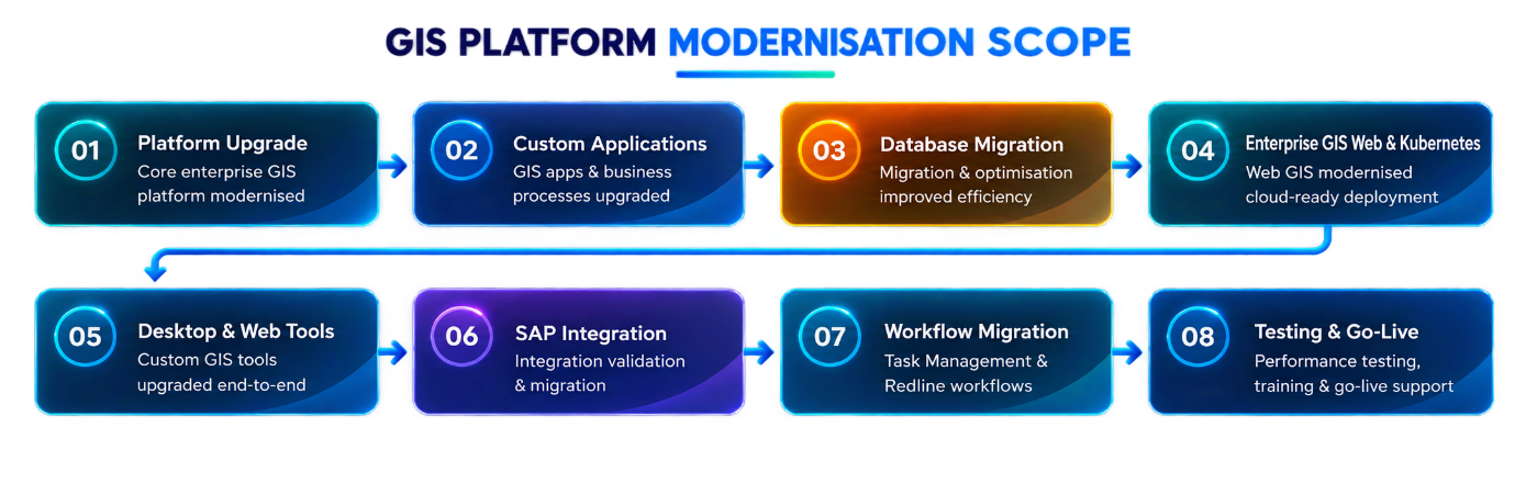
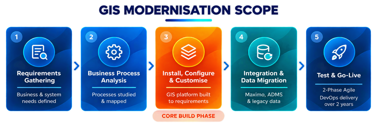
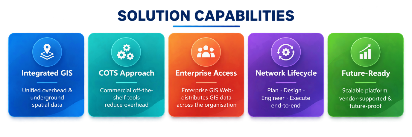
The integrated GIS solution was structured across five core delivery areas, each contributing to the overall objective of a unified, enterprise-ready spatial management environment.
1. Integrated GIS Implementation
RedPlanet Solutions deployed a unified spatial management system capable of managing both overhead and underground network infrastructure within a single GIS environment. The implementation brought previously separate network datasets into a common platform, providing a single spatial view of the full network estate for the first time.
2. Commercial-Off-The-Shelf Adoption
A COTS approach was adopted as the implementation strategy, leveraging proven commercial enterprise GIS products to reduce customisation overhead, ensure long-term vendor support and provide a well-documented, maintainable GIS environment. This approach also reduced implementation risk by building on established, proven technology rather than developing bespoke solutions from scratch.
3. Enterprise GIS Platform Deployment
The enterprise GIS platform provided the spatial foundation for network planning, design, engineering and infrastructure execution activities. It formed the central component of the integrated GIS environment, supporting a wide range of network infrastructure management functions within a single vendor-supported platform.
4. Enterprise-Wide GIS Access
Enterprise GIS Web was deployed to provide enterprise-wide access to GIS information. Stakeholders across the organisation — including operational teams, engineers and customer-facing functions — were able to access network data through a browser-based interface connected to the core GIS environment, extending the reach and utility of the spatial platform beyond the core GIS desktop users.
5. End-to-End Network Operations
The integrated GIS environment was designed to support the full network operations lifecycle. By bringing together network data, GIS applications and enterprise access in a single-vendor integrated environment, the solution enabled end-to-end support for planning, design, engineering, service management and network operations. The resulting platform was characterised as scalable, vendor-supported and future-proof.
Technology Stack
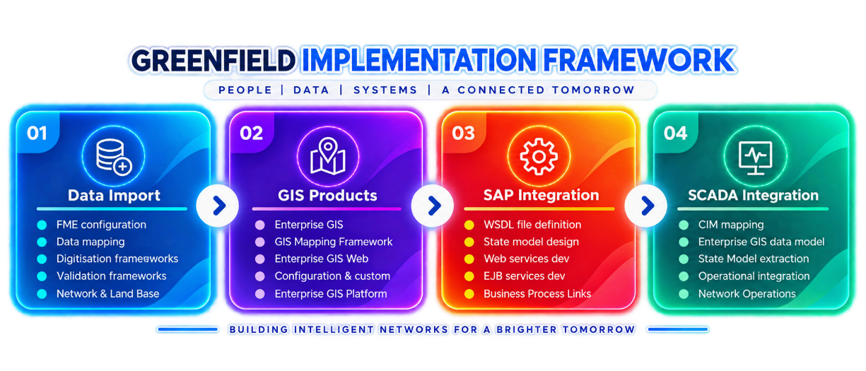
- GIS & Web: Enterprise GIS Platform (desktop · web · mobile) · GIS Design Manager · Enterprise GIS Web · Enterprise GIS Services
- Enterprise & Mobile: Geospatial Analysis Tools · Mobile GIS Application · Kubernetes
- Platform & Data: Enterprise Gateway · Diagnostics · Google Maps · FME Desktop · PostgreSQL
Conclusion
The Integrated GIS project established a unified spatial management environment for an energy and industrial organisation in Saudi Arabia, bringing overhead and underground network data into a single enterprise GIS platform for the first time. The COTS-based implementation approach, combined with enterprise-wide GIS access through Enterprise GIS Web and structured support for the full network operations lifecycle, delivered a scalable, integrated and future-ready GIS environment. The project represents a strong example of how a well-structured Integrated GIS implementation can unify complex network environments and extend the value of spatial data across a large organisation.