A long-term enterprise GIS programme covering system upgrades, business process integration, data governance, network data migration, technical support and system optimisation.
Overview
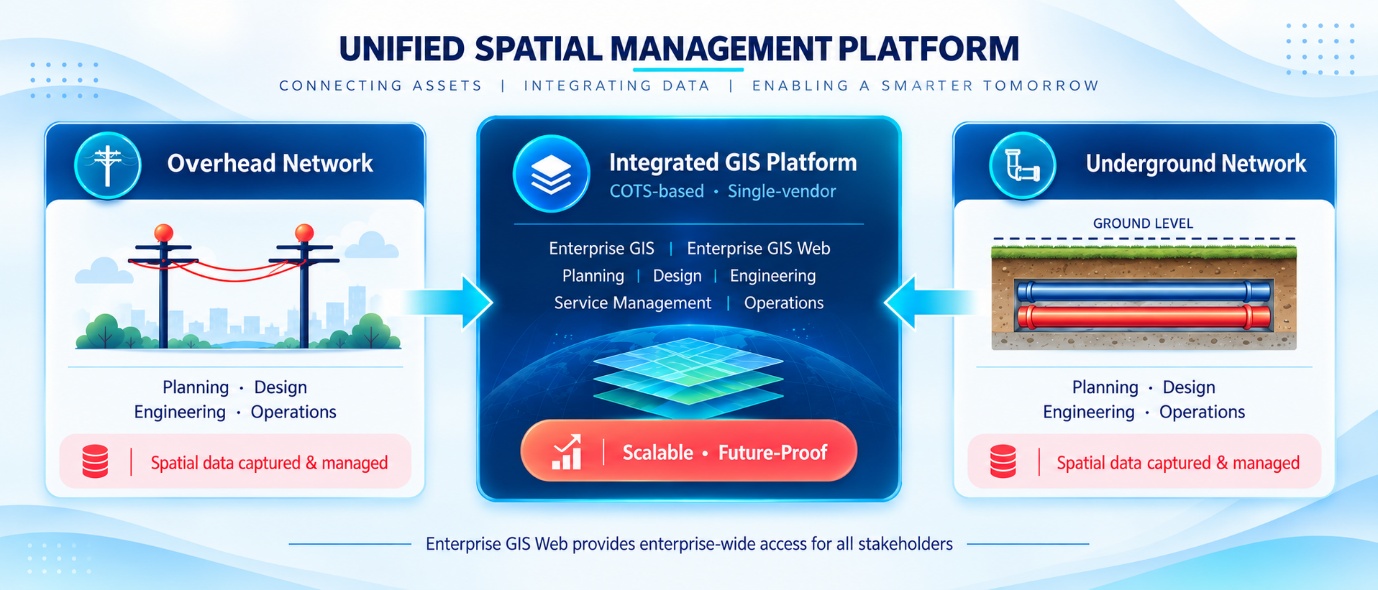
A leading electric company in Malaysia engaged RedPlanet Solutions to implement, upgrade and maintain a centralised enterprise GIS environment in support of operations across six business divisions. The programme has spanned more than 10 years, with the GIS environment evolving continuously to address changing operational, integration, data management and system performance requirements across the organisation. Over this period, the GIS platform has grown from an initial implementation into a mission-critical enterprise system connecting spatial data with business processes, enterprise applications, mobility systems and analytical platforms.
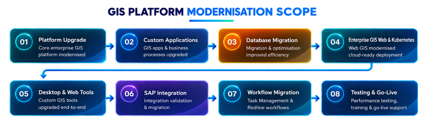
RedPlanet Solutions’ long-term scope has covered the breadth of enterprise GIS delivery: platform implementation and upgrade, 21 business process integrations, mobility integration for field operations, enterprise-wide data governance, network data migration, Level 1 and Level 2 technical support, system and database administration, and diagnostics-led performance optimisation.
The Challenge
The enterprise GIS environment was required to support diverse and evolving operational needs across six business divisions — Generation, Transmission, Distribution, Corporate Affairs & Services, ICT, and Strategic & Regulatory — while simultaneously integrating with multiple external enterprise and operational systems. Managing GIS at this scale and complexity over an extended period required disciplined data governance, a reliable strategy for ongoing network data migration, mobility integration to support field workforce operations, and continuous system performance management.
The GIS platform also needed to act as a data source for downstream systems and a data lake supporting enterprise analytics, making it a central component of the organisation’s wider technology landscape. The challenge was not simply to maintain the GIS system, but to actively evolve it as business requirements changed, new integrations were added and system performance demands increased over time.
Solution Scope
The programme covered the implementation, upgrade and maintenance of the corporate GIS system across all six divisions. A total of 21 business processes were implemented and integrated with external systems in accordance with the organisation’s standard operating procedures, providing structured, GIS-enabled workflows across the full breadth of the organisation’s operational activities.
Enterprise Integration
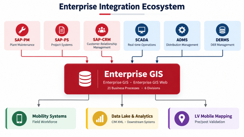
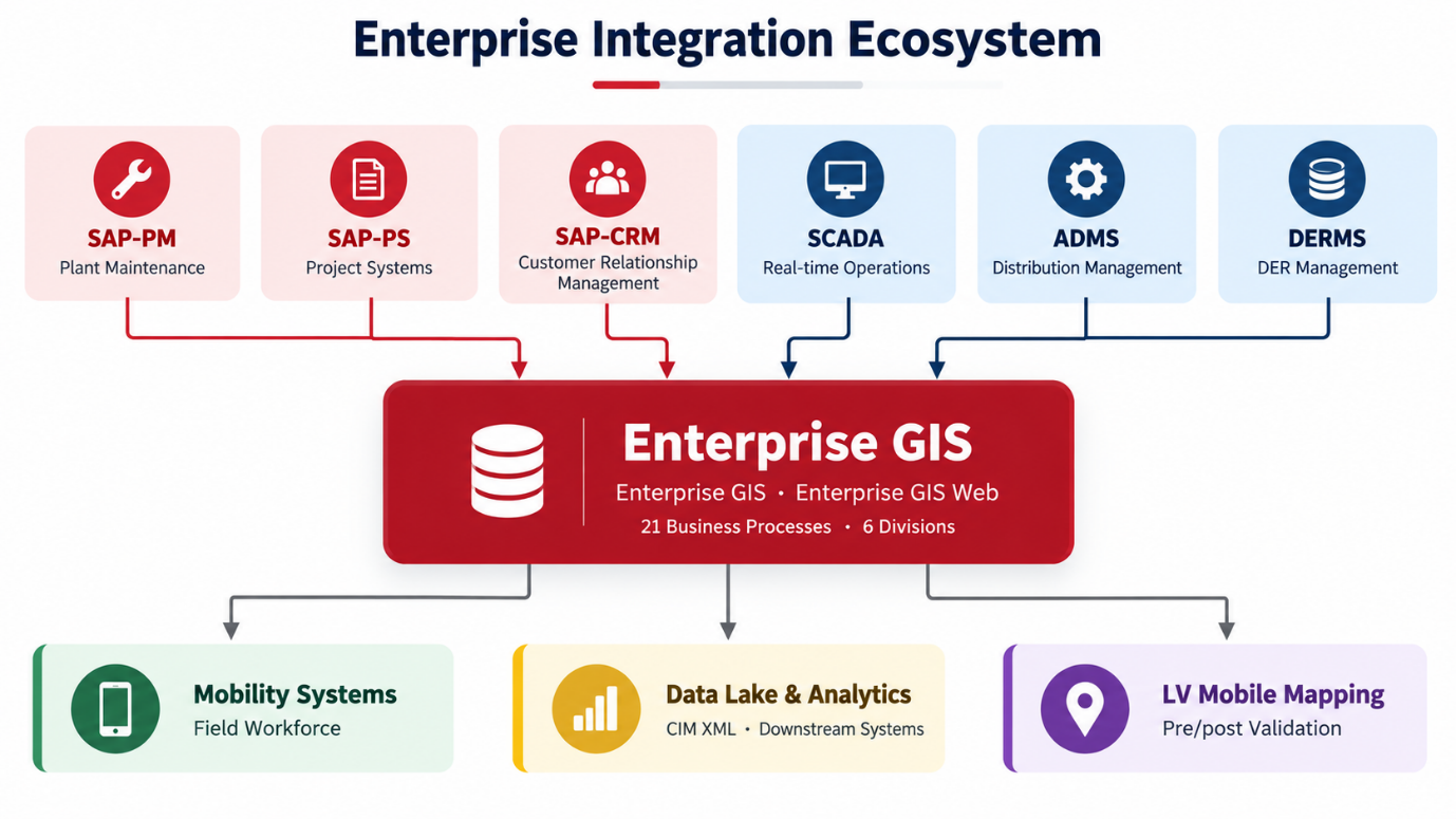
The GIS environment was integrated with SAP-PM for plant maintenance, SAP-PS for project systems and SAP-CRM for customer relationship management, connecting spatial asset data with the organisation’s core enterprise resource planning environment. Operational integrations included SCADA for real-time network control, ADMS for distribution management and DERMS for distributed energy resource management. Extensive GIS-to-mobility system integration was also implemented, enabling field workforce teams to access and update GIS data from mobile devices as part of their operational workflows.
Data Governance & Network Data
An enterprise-wide data governance framework was implemented to maintain data quality and support consistent GIS utilisation across the organisation. Automated Key Success Factor (KSF) measurements were introduced to monitor data quality levels and system engagement on an ongoing basis. Network model information was migrated from GIS to ADMS using CIM XML to support real-time distribution operations. GIS data was also shared with downstream systems and a data lake to support enterprise analytics requirements. Low Voltage data collected through mobile mapping activities was migrated into GIS using pre- and post-validation scripts, ensuring data accuracy and completeness after each mobile data collection cycle.
Support, Administration & Optimisation
RedPlanet Solutions provided ongoing Level 1 and Level 2 technical support for GIS products and custom solutions under the organisation’s SLA requirements, ensuring continuity of operations and timely resolution of system issues. System and database administration activities covered database compression, security management, patch application, access configuration and regular health checks. Diagnostics tooling was implemented to proactively identify performance bottlenecks and guide targeted optimisation activities, supporting sustained system performance across the GIS environment over the long term.
Technology Stack
- Enterprise GIS Platform (desktop · web · mobile) — core utility GIS environment including GIS Design Manager and Enterprise GIS Web
- Geospatial Analysis Tools — spatial network analysis, asset querying, proximity analysis, network tracing and geospatial data visualisation
- Enterprise Gateway · Diagnostics — operational monitoring and performance tools
- Google Maps · FME Desktop & Server · PostgreSQL — integration and data platform
Conclusion
This case study illustrates the scale and sustained complexity of managing an enterprise GIS environment over the long term within a large, multi-division utility organisation. Across 10+ years, the engagement has encompassed initial implementation, platform upgrades, 21 business process integrations spanning six divisions, integration with SAP, SCADA, ADMS and DERMS, enterprise data governance with automated KSF monitoring, GIS-to-ADMS network model migration using CIM XML, LV data migration with pre- and post-validation, and diagnostics-led performance optimisation — all delivered under a continuous long-term managed services and delivery partnership with RedPlanet Solutions.