
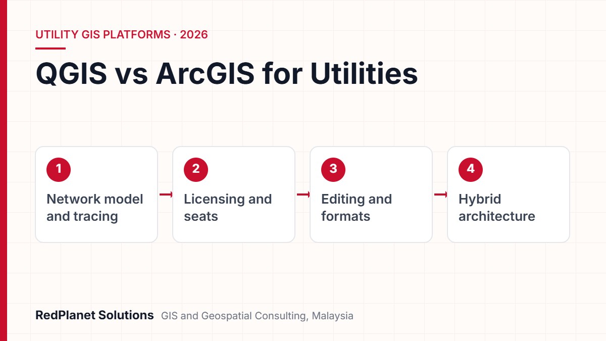
In the QGIS vs ArcGIS choice, ArcGIS fits teams that need a shared, rule-based network model. That is because the ArcGIS Utility Network adds tiers, subnetworks, tracing and versioned editing. QGIS, in contrast, fits viewing, mapping, data clean-up and low-cost desktop seats. So many network owners run both: one system of record, with QGIS beside it.
- ArcGIS Utility Network is a purpose-built model with tiers, subnetworks and tracing, delivered through ArcGIS Pro and ArcGIS Enterprise.
- QGIS is free, open source software under the GNU GPL, but it has no built-in match for a full network model.
- In ArcGIS, shared network editing needs branch versioning, feature services and the Advanced Editing extension, so plan licences and design together.
- QGIS reads and writes many formats, including file geodatabases through GDAL, so it makes a strong companion tool.
- A hybrid setup, with one system of record and QGIS for wider use, is often the most practical answer.
What is the short answer to QGIS vs ArcGIS for utilities?
The short answer is that they are not direct swaps. ArcGIS gives you a shared, rule-based network model through the ArcGIS Utility Network. QGIS gives you a capable, free desktop GIS. It suits viewing, mapping, data clean-up and light editing.
So the real question is not which tool is better. Instead, ask which jobs your network data must support. Then ask who does each job. For example, a planner tracing a feeder needs different tools from an analyst making a tree risk map.
RedPlanet works with both tools. We also work with GE Vernova Smallworld, Hexagon and SuperMap. As a result, this guide stays neutral. You can read more on our QGIS services and Esri ArcGIS services pages.
In our experience, network owners rarely struggle because they chose the wrong brand. Problems start when the network model, the editing rules and the people who keep them are not planned together.RedPlanet Solutions
How do QGIS and ArcGIS licensing models differ?
QGIS is open source and has no licence fees. ArcGIS, on the other hand, is sold per named user. That one gap shapes budgets, buying rules and how far each tool can spread.
QGIS: open source under the GNU GPL
The official QGIS docs say it is released under the GNU General Public License. As a result, users can read and change the source code. In addition, it runs on Windows, macOS and most Unix systems. So you can install it on every desk with no seat count. But free software still has costs. For instance, you pay for training, support, plugin upkeep and the staff who set it up.
QGIS also has a steady release rhythm. First, a new version comes out every four months. In addition, every third release is a Long Term Release. Then that LTR gets bug fixes until the next one arrives. For network teams, the LTR is the safe baseline because it changes less often.
ArcGIS: named users and user types
ArcGIS sells named user licences in tiers called user types. First, Viewer, Contributor and Mobile Worker cover light roles. Next come Creator, Professional and Professional Plus, which include ArcGIS Pro at rising levels. Also, the top two include the Advanced Editing extension. This matters because network editing needs it. Prices vary by deal and region, so check them with Esri or its local partner. In Malaysia, that partner is Esri Malaysia.
There is a public sector angle in Malaysia too. The government launched its Public Sector Open Source Software Master Plan in July 2004. Since then, MAMPU has led it. As a result, some agencies already have open source rules that favour tools like QGIS.
Can QGIS model a utility network the way ArcGIS Utility Network does?
No, not out of the box. The ArcGIS Utility Network is a true network data model. QGIS, by contrast, stores lines and points with fields. So it needs plugins or custom code to handle connections. In fact, this is the biggest technical gap between the two.
Esri lists the main building blocks. First, a network holds one or more domain networks, such as electric supply. Next, a structure network models poles and vaults. Then, inside each domain, features sit in tiers. For example, each tier is usually a voltage or pressure level. Finally, subnetworks such as feeders are found by tracing. Also, the trace starts at a source and stops at open switches or closed valves.
Domains and tiers
First, each domain models one system. Tiers limit which feature types are valid at each voltage or pressure level.
Subnetworks and tracing
Feeders and pressure zones are traced from a source. So the model shows the current switch and valve states.
Links between features
Features link to each other, to cabinets and vaults, and to poles. As a result, the asset picture stays complete.
Rules and terminals
Rules and device terminals check each edit. As a result, paths through the network stay valid.
Esri also ships ready-made starting points. For example, the Electric Utility Network Foundation gives you a preset asset package, maps, styles and common data workflows. So power firms do not have to design every class from scratch. If you plan GIS for electric utilities, this can cut design time.
QGIS can still do useful network work. For instance, it can find shortest paths, check line snapping and flag broken segments. However, it does not enforce tiers, sources or rules across a shared database. So if outage or planning work depends on a trusted model, QGIS alone is usually not enough.
Already run another network GIS, such as GE Vernova Smallworld? Then the choice changes. In that case, QGIS competes with ArcGIS only for desktop viewing seats, not for the network model.
How do editing workflows and data formats compare?
ArcGIS offers controlled, versioned editing for the network. QGIS offers flexible editing across many open formats. So which matters more depends on whether your edits must obey a network model.
Editing in ArcGIS Utility Network
In a server setup, the network is registered as branch versioned. Then it is shared as a feature service. Esri’s publishing guide says branch versions can only be edited through feature services. In addition, it says editors need the Advanced Editing extension. However, query and trace do not need it. So viewers can trace without an editing licence.
Branch versioning lets many editors work on the same network. Then they reconcile and post their changes. Meanwhile, network rules check each edit as it happens. This helps, for example, when dozens of field and office staff update the same feeders.
Editing and formats in QGIS
QGIS edits shapefiles, GeoPackage, PostGIS and many other sources directly. It also reads WMS, WMTS, WCS, WFS and OGC API Features services. In addition, it can edit through WFS-T. QGIS can connect to ArcGIS REST servers too. As a result, teams can view and query shared map and feature services.
File geodatabase access comes through GDAL. For instance, its OpenFileGDB driver has had write and update support since GDAL 3.6. Even so, writing from QGIS does not apply ArcGIS network rules. Therefore, use QGIS for simple feature classes, not for edits inside the network.
- Best done in ArcGIS: connected network edits, subnetwork updates and shared versioned editing.
- Well suited to QGIS: data clean-up, digitising backlogs, PostGIS queries, theme maps and quick QA checks.
- Either tool: map output, simple edits on non-network layers and reading open formats.
Which platform is stronger for enterprise integration, support and skills?
ArcGIS offers a more packaged stack and one vendor to call. QGIS offers open standards and a large community. Also, both can link to SAP, SCADA, ADMS and asset systems. But the routes differ.
Links to other systems
ArcGIS Enterprise exposes REST services, including network tasks such as tracing. So developers get a documented way to call them from outage or work systems. QGIS, however, usually links through the database, often PostGIS. It also uses OGC services, such as those from GeoServer. Tools such as FME can then bridge both worlds when data must move.
Support and skills
Esri gives vendor support, docs and training. In addition, it has a large partner network. For QGIS, the project lists paid support firms on its website. Then these are grouped into core contributors, contributors and others. Many of them also offer training and custom builds.
Skills matter too. For example, many GIS graduates learn both tools. But network model admin is a rare skill in either camp. So budget for training whichever tool you pick. Also check your desktops, because ArcGIS Pro does not run natively on macOS. QGIS, by contrast, does.
Not sure whether you need a full network model or a lighter QGIS setup?
Talk To Our Consultants →How do QGIS and ArcGIS compare side by side?
The table below sums up the main gaps for network data. However, it stays general, because exact features depend on version, setup and licence level.
| Criterion | QGIS | ArcGIS |
|---|---|---|
| Licensing. | Open source, no seat fees. | Named user types. |
| Network model. | None built in. | Utility Network with tiers. |
| Tracing. | Basic routing and scripts. | Built-in network traces. |
| Shared editing. | Database level, such as PostGIS. | Branch versioning. |
| Data formats. | Very broad, via GDAL. | Geodatabase first, wide import. |
| Server side. | QGIS Server or GeoServer. | ArcGIS Enterprise or Online. |
| Support. | Community and paid firms. | Vendor and partners. |
| Desktop. | Windows, macOS, Linux. | ArcGIS Pro on Windows. |
| Templates. | Community plugins. | Foundation solutions. |
Neither column wins outright. However, the network model row usually decides the system of record for power, gas and water. The other rows then decide how widely each tool is used around it.
When does a hybrid QGIS and ArcGIS setup make sense?
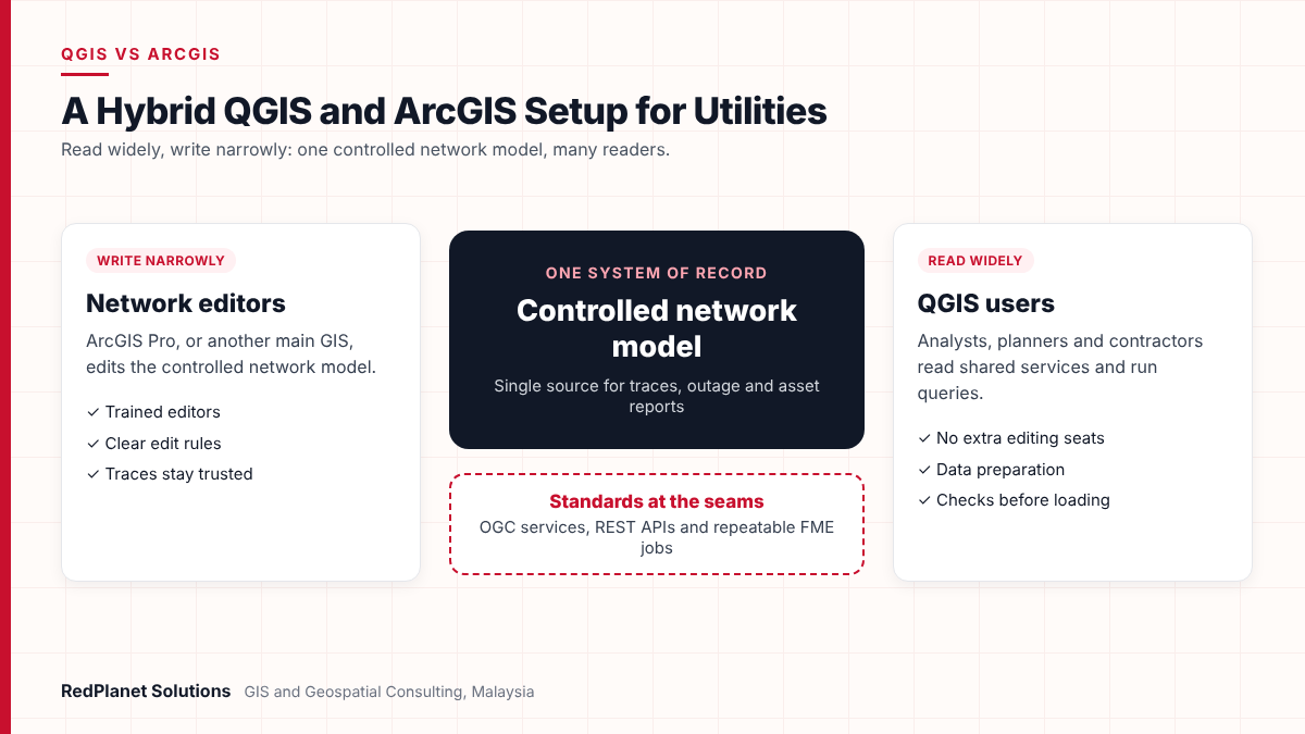
A hybrid setup makes sense when one main GIS holds the network model. Meanwhile, many other users only need to view, query or prepare data. In that case, QGIS widens access without adding editing licences for every desk.
A common pattern looks like this. First, network editors work in ArcGIS Pro, or in another main GIS, against the controlled model. Next, analysts, planners and contractors use QGIS to read shared services and run queries. In addition, they use it to prepare data for loading. Our guide to QGIS for utilities and infrastructure teams covers these roles in more detail.
One system of record
Keep network edits in one controlled database. That way, traces and reports stay trusted.
Read widely, write narrowly
Let many users read services and exports. But limit network writes to trained editors with clear rules.
Standards at the seams
Use OGC services, REST APIs and repeatable FME jobs. Then data moves cleanly between tools.
Hybrid setups also help during moves to a new model. For instance, QGIS is handy for checking and cleaning old CAD or shapefile data before loading. Careful GIS data migration at this stage stops broken links that cost a lot to fix later.
Which should your utility choose? A practical decision guide
Choose based on the work your network data must support. So do not choose on licence cost alone. Next, the guide below maps common cases to a sensible starting point.
You need a shared, traceable network model that feeds outage or planning work.
ArcGIS Utility Network, or your current network GIS, as the system of record.
You already run a network GIS and need more viewing seats.
QGIS beside it, reading shared services and exports.
You are a small operator or project team with simple asset lists.
QGIS with PostGIS, plus clear editing steps and QA checks.
You prefer open source but also need full network tracing.
A hybrid design, with the model in one main GIS and QGIS for wider use.
Comparing licence fees only
Training, support, links to other systems and data quality often cost more than licences.
Editing network data in two places
Parallel edits in QGIS and ArcGIS create clashing versions. As a result, traces break.
Skipping user type planning
Network editors need the right ArcGIS user types and extensions. So map roles before you buy.
Skipping data quality checks
Poor links in source data become failed traces in the new model, whichever tool you pick.
Treating plugins as products
Community plugins can be excellent. But check who maintains them before you rely on them.
Before you decide
Work through these points with IT, operations and GIS leads.
Planning to bring in outside help? Then our guide on how to choose a GIS consulting firm lists good questions to ask any partner.
Frequently Asked Questions
Is QGIS a full replacement for ArcGIS in a utility?
Usually not for the network system of record. QGIS has no built-in match for the ArcGIS Utility Network, with its tiers, subnetworks and rule-based tracing. However, it can replace ArcGIS for many viewing, mapping and data clean-up tasks. In many firms, that covers a large share of users.
Can QGIS edit an ArcGIS Utility Network?
Not in a supported, rule-aware way. Esri states that branch versioned network data is edited through feature services. Editors work from ArcGIS Pro or web apps, with the Advanced Editing extension. QGIS can view and query ArcGIS REST services. But network edits should stay in Esri tools so that connections stay valid.
Can QGIS open Esri file geodatabases?
Yes. QGIS uses GDAL, and its OpenFileGDB driver reads file geodatabases. It has also supported write and update since GDAL 3.6. Some compressed data cannot be read, though. Also, writing from QGIS does not apply ArcGIS network rules. So limit it to simple feature classes, not network content.
Which ArcGIS user type do utility network editors need?
Editors need an account with the ArcGIS Advanced Editing extension. Esri includes it with the Professional and Professional Plus user types. Query and trace do not need the extension. User types can change between releases, so confirm the current list with Esri or your local partner before you buy.
Is QGIS suitable for government agencies in Malaysia?
It can be, for the right work. Malaysia launched a Public Sector Open Source Software Master Plan in 2004, and MAMPU leads it. So open source tools are familiar in the public sector. Still, agencies need to plan support, training and data rules, especially for key infrastructure data.
What is the most common hybrid setup for utilities?
The most common pattern keeps network editing in one main GIS, such as ArcGIS. Meanwhile, analysts, planners and contractors get QGIS for viewing and queries. Then data flows through shared services, database views or FME jobs. See our QGIS services page for how this can be set up.
So which fits your network data workflow, QGIS or ArcGIS?
For the main network model, ArcGIS Utility Network is the stronger fit. That is because it was built for tiers, subnetworks, tracing and shared editing. QGIS, in contrast, is the stronger fit for wide, low-cost access to viewing, mapping and data clean-up.
So for most network owners, the answer is not one or the other. First, decide where your system of record lives. Then use QGIS where it adds reach without risk to the model. If you want a neutral view, talk to our GIS consultants about your network data workflow.
Expert Guides
Related GIS Guides
 GuideQGIS for Utilities and Infrastructure Teams: A Practical GuideA practical guide to QGIS for utilities: editing network data, plugins, LTR releases, PostGIS and GeoServer links, limits, costs and support options.Read the guide →
 GuideMobile GIS Data Collection for Utilities: Field Workflows That Cut ReworkMobile GIS data collection for utilities: form design, GNSS accuracy, offline sync, photo standards and QA at source that cut field rework.Read the guide →
Need a neutral view on QGIS, ArcGIS or both?
RedPlanet Solutions designs and supports network GIS on Esri ArcGIS, QGIS, GE Vernova Smallworld, Hexagon and SuperMap. We can review your network data workflows and suggest a practical setup.
Talk To Our GIS Consultants
PK Senthilkumar is CEO of RedPlanet Solutions. His work focuses on GIS consulting, network-based GIS for utilities, enterprise GIS modernisation and practical spatial decision-making for organisations operating across Malaysia, India, Australia and international markets.
About RedPlanet Solutions
RedPlanet Solutions (M) Sdn Bhd is a Malaysia-based GIS consulting and geospatial services company and part of RedPlanet Berhad. The company delivers GIS for electric utilities, spatial data collection, drone surveying, mobile mapping and GIS software development to utilities, government agencies, smart cities and private sector organisations across Southeast Asia, the Middle East, Australia and beyond. RedPlanet works across leading commercial and open-source GIS ecosystems, including GE Vernova Smallworld, Esri, Hexagon, SuperMap, QGIS, GeoServer and FME.