Replacing a legacy GIS environment with a modern enterprise GIS solution, supported by enterprise integration, data migration and phased Agile delivery.
| Country | Project Duration | Delivery Phases | Delivery Approach |
|---|---|---|---|
| Philippines | 2 Years | 2 | DevOps + Agile |
Overview
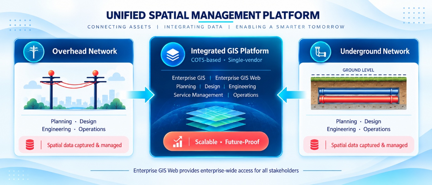
An Electric Utility in the Philippines undertook a comprehensive modernisation of its Geographic Information System (GIS) environment, replacing an ageing legacy GIS platform with a modern enterprise GIS solution. The utility operates an electricity distribution network covering both sub-transmission and distribution infrastructure, with assets spanning overhead radial networks, underground cable systems and secondary network connections serving a large customer base across its licensed service area.
RedPlanet Solutions was engaged to manage the full transition from the existing GIS environment to the new enterprise GIS platform. The scope covered business requirement analysis, system installation and configuration, application customisation, structured testing, full platform implementation, enterprise system integration and data migration. The project was structured as a two-phase delivery over two years, executed using a DevOps and Agile methodology, with the entire build environment hosted within the utility’s own infrastructure to meet security and data sovereignty requirements.
The Challenge
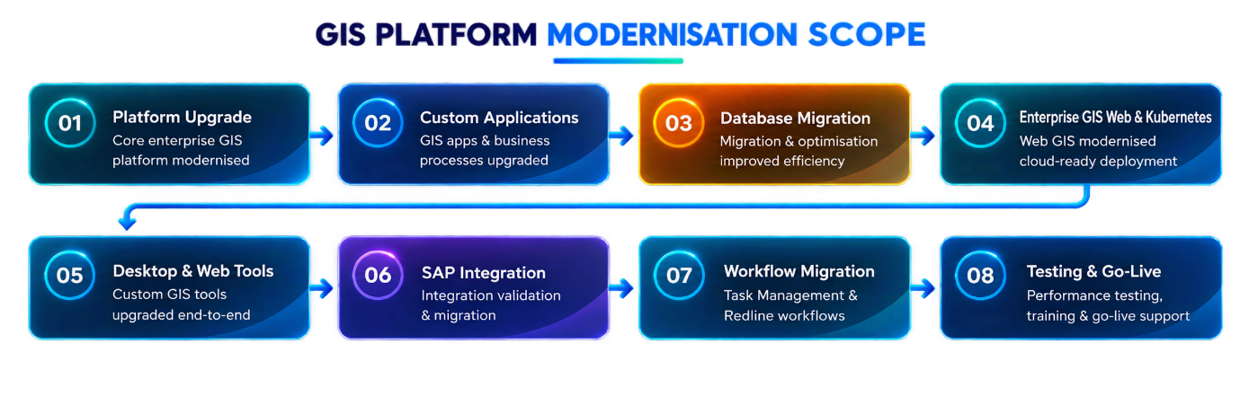
The utility’s legacy GIS system had reached the operational limits of its design and could no longer support the organisation’s evolving requirements. A full platform replacement was necessary. Moving to a new enterprise GIS environment required a structured transition programme covering existing business processes, application and customisation requirements, the integration of the new platform with external enterprise systems, and the migration of all accumulated GIS data into the new database environment — without disrupting day-to-day operations.
The replacement solution was required to integrate with two critical enterprise and operational systems that depended on GIS data for their functions:
- Enterprise Asset Management using IBM Maximo — supporting maintenance workflows and work order management
- Advanced Distribution Management System (ADMS) — supporting real-time distribution network operations
These integration requirements elevated the project beyond a straightforward platform swap. It required a structured enterprise architecture programme covering requirements analysis, platform implementation, enterprise integration design and data migration planning — all delivered in a live operational environment.
Project Scope
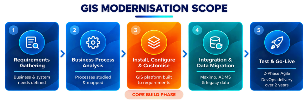
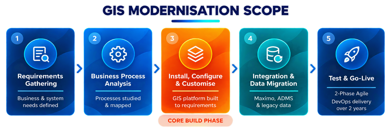
RedPlanet Solutions managed the GIS modernisation across five structured work areas, progressing from requirements capture through to phased go-live. The project opened with detailed requirement gathering, engaging business and operational stakeholders to define how the new platform needed to support existing workflows. This foundation informed all subsequent configuration and customisation decisions.
Business process analysis followed, with RedPlanet Solutions studying and documenting the utility’s operational processes to ensure the enterprise GIS environment could be configured to match them precisely. Software installation and configuration was completed based on the agreed requirements, with the platform subsequently customised to fit the utility’s operational context. Structured testing was conducted before deployment, and a two-phase go-live approach was used to manage transition risk and validate the platform under operational conditions before full rollout.
Enterprise System Integration
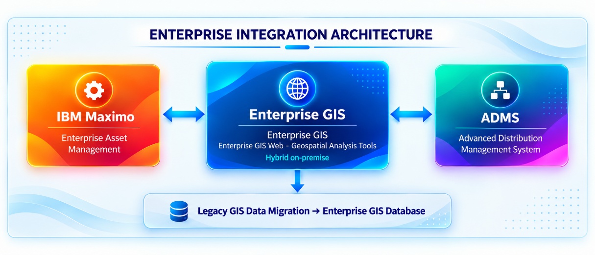
The enterprise GIS platform was integrated with IBM Maximo to support Enterprise Asset Management. This integration enabled asset records maintained within GIS to be linked with maintenance workflows, inspection records and work orders managed in Maximo — creating a connected view of spatial and asset lifecycle data across the organisation.
The GIS environment was also integrated with the utility’s Advanced Distribution Management System (ADMS), connecting geospatial network data with real-time distribution operations. This integration ensured that network topology information maintained in GIS was available to support operational decision-making in the ADMS environment. Together, these integrations formed the core of the wider GIS implementation architecture and represented a significant coordination effort across multiple technical teams.
GIS Data Migration
Legacy GIS data migration was a critical component of the transition programme. RedPlanet Solutions managed the full migration of GIS data from the existing legacy platform into the new enterprise GIS database environment. The process included data profiling, mapping, transformation and validation to ensure that all spatial records were accurately translated into the new data model, with data quality validated both before and after migration to confirm completeness and integrity.
Technology Stack
- Enterprise GIS Platform (desktop · web · mobile) — core utility GIS environment
- Enterprise GIS Web — browser-based GIS access across the organisation
- Geospatial Analysis Tools — spatial network analysis, asset querying, proximity analysis, network tracing and geospatial data visualisation
- Mobile Enterprise — field workforce mobile GIS access
- Microsoft SQL Server — relational database platform
Conclusion
The GIS modernisation programme delivered a modern, integrated enterprise GIS environment for an Electric Utility in the Philippines, replacing a legacy platform with a structured and scalable solution built to support the utility’s current and future operational requirements. The two-year, two-phase Agile delivery demonstrated RedPlanet Solutions’ capability to manage complex GIS transitions — spanning business analysis, platform implementation, enterprise system integration with IBM Maximo and ADMS, and full legacy data migration — while maintaining operational continuity throughout.