
Managing large-scale oil palm plantations demands clarity, accuracy, and speed — yet traditional mapping and reporting often fall short.
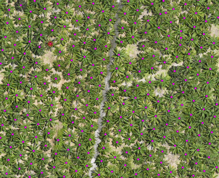
Our AI-Driven Digitizing & Analysis Solutions for Oil Palm transform raw spatial data into an intelligent schematic display, giving plantation managers a clear, actionable view of their estates — from individual palms to estate-wide performance.
By combining AI, LiDAR, drone imagery, and GIS, we automatically digitize plantation features and convert them into structured, decision-ready insights.
What our AI-powered solution delivers:
- Automated palm tree detection, counting, and spatial digitizing
- Health, growth, and density analysis using AI analytics
- Clear schematic maps showing blocks, rows, palms, roads, drains, and infrastructure
- Identification of underperforming, missing, or stressed palms
- Faster reporting with reduced field surveys and manual digitizing
- Reliable data for yield forecasting, replanting, and estate planning
Designed for plantation owners, estate managers, and agronomy teams, this solution reduces operational costs, improves productivity, and provides a scalable digital foundation for precision agriculture and plantation digital twins.
🌴 From raw data to clear schematics — manage your plantation with intelligence and confidence.
Contact us today to learn how AI-powered digitizing and schematic analysis can elevate your oil palm operations.