Satellite Images

Satellite imagery provides a powerful bird’s-eye view of the world — revealing land use, infrastructure, vegetation, and environmental change with remarkable clarity and accuracy. RedPlanet Solutions gives you access to high-resolution satellite imagery sourced from leading global providers, tailored to your project’s needs, whether for mapping, monitoring, planning, or analysis. From one-off image requests to ongoing imagery subscriptions, our team helps you find and source the right data to support informed decision-making on the ground.

OVERVIEW

What Is Satellite Imagery?

Satellite imagery refers to photographs and sensor data captured by Earth-observation satellites orbiting at altitudes from 300 to 600 miles above the surface. Unlike aerial photography or drone surveys, satellite imagery provides global coverage without local deployment, making it well suited for monitoring large areas, remote locations, and changes over time.

In the context of satellite remote sensing, imagery extends well beyond visible-light photography. Modern Earth-observation satellites collect data across multiple spectral bands, including near-infrared (NIR), shortwave infrared (SWIR), thermal, and radar. This enables analysis of vegetation health, soil moisture, surface temperature, mineral composition, and land cover change that optical cameras alone cannot detect.

RedPlanet Solutions provides commercial satellite imagery services, delivering georeferenced data layers tailored to your accuracy requirements across optical, multispectral, thermal, and SAR sensor types.

Why Satellite Imagery?

Satellite data offers what terrestrial methods cannot: Infinite Scale and Historical Memory.

The Orbital Advantage

  • Global Access, Zero Logistics: Monitor remote sites, border-to-border assets, or offshore installations without deploying a ground crew.
  • Rapid Revisit Rates: Access daily imagery to track site progress, stockpile changes, or environmental shifts in near real-time.
  • The Archive: Reach back years into historical data to compare today’s conditions with past benchmarks for legal or environmental audits.

These orbital advantages make satellite imagery the preferred data source for projects where scale, speed, or historical analysis are critical, and where deploying ground crews or drone fleets across the full area of interest would be impractical, unsafe, or cost-prohibitive. From monitoring oil palm plantations across thousands of hectares to tracking infrastructure changes along international pipeline corridors, satellite remote sensing delivers the spatial intelligence that ground-based methods cannot match at scale.

Technical Capabilities

We don’t just provide pictures; we provide georeferenced data layers tailored to your accuracy requirements.

Optical and High-Resolution Imagery

  • Sub-Metre Clarity: Identify individual assets, vehicles, and structural footprints from 300 miles above.
  • True Colour (RGB): High-fidelity imagery for visual inspection and project stakeholder presentations.

Sub-metre high-resolution satellite imagery, sourced from platforms including Maxar WorldView-3, WorldView-Legion, and Planet Labs SkySat, delivers sufficient detail to identify individual vehicles, measure structural footprints, monitor construction progress, and assess damage after natural disasters. At resolutions of 30 to 50 cm per pixel, this class of commercial satellite imagery bridges the gap between traditional aerial photography and satellite-scale coverage, providing both the detail and the geographic extent that large-scale projects require.

Beyond the Visible: Spectral Intelligence

  • Multispectral (SWIR/NIR): Detect vegetation health (NDVI), soil moisture, and mineral composition.
  • Thermal Sensing: Monitor heat signatures for industrial output or urban heat island analysis.
  • SAR (Synthetic Aperture Radar): See through clouds, smoke, and darkness. Suited for 24/7 monitoring in tropical or high-latitude regions.

Multispectral and Hyperspectral Analysis

Multispectral satellite data captures imagery across defined spectral bands including visible, near-infrared (NIR), and shortwave infrared (SWIR). This enables quantitative analysis of surface properties invisible to standard cameras. Key analytical products derived from multispectral satellite imagery include:

  • NDVI (Normalized Difference Vegetation Index): Measures vegetation density and health by comparing NIR and red band reflectance. Used in precision agriculture, forestry monitoring, and environmental compliance.
  • Soil Moisture Index: Derived from SWIR bands to map soil water content across agricultural and hydrological study areas.
  • Mineral Composition Mapping: SWIR spectral analysis identifies surface mineralogy for geological survey, mining exploration, and soil classification.
  • Land Surface Temperature: Thermal bands deliver surface temperature data for urban heat island mapping, industrial monitoring, and climate studies.

SAR Satellite Imagery: All-Weather, Day and Night Monitoring

Synthetic Aperture Radar (SAR) is a form of active radar remote sensing that transmits microwave pulses toward the Earth’s surface and records the reflected signal, producing high-resolution imagery regardless of cloud cover, smoke, haze, or darkness. Unlike optical satellite sensors that depend on sunlight and clear atmospheric conditions, SAR satellites acquire data 24 hours a day, 7 days a week, in any weather.

SAR satellite imagery is critical for monitoring in tropical regions, where persistent cloud cover makes optical imagery unreliable, and for applications requiring continuous temporal coverage, including:

  • Flood Mapping and Disaster Response: SAR penetrates cloud cover that obscures disaster zones, enabling rapid damage assessment and flood extent mapping in near real-time.
  • Deformation and Subsidence Monitoring: InSAR (Interferometric SAR) techniques detect millimetre-scale ground movement, which is essential for monitoring land subsidence, dam stability, and infrastructure integrity.
  • Maritime and Vessel Detection: SAR detects vessel positions and movements across open ocean regardless of weather, supporting maritime surveillance, oil spill response, and fisheries monitoring.
  • Forest Change Detection: SAR L-band data penetrates forest canopy to detect clearance, degradation, and biomass change in tropical forests where cloud-free optical coverage is rare.
  • Agricultural Crop Monitoring: Repeat-pass SAR data tracks crop growth cycles, harvest events, and field condition changes across the growing season.

Satellite Imagery Products and Examples

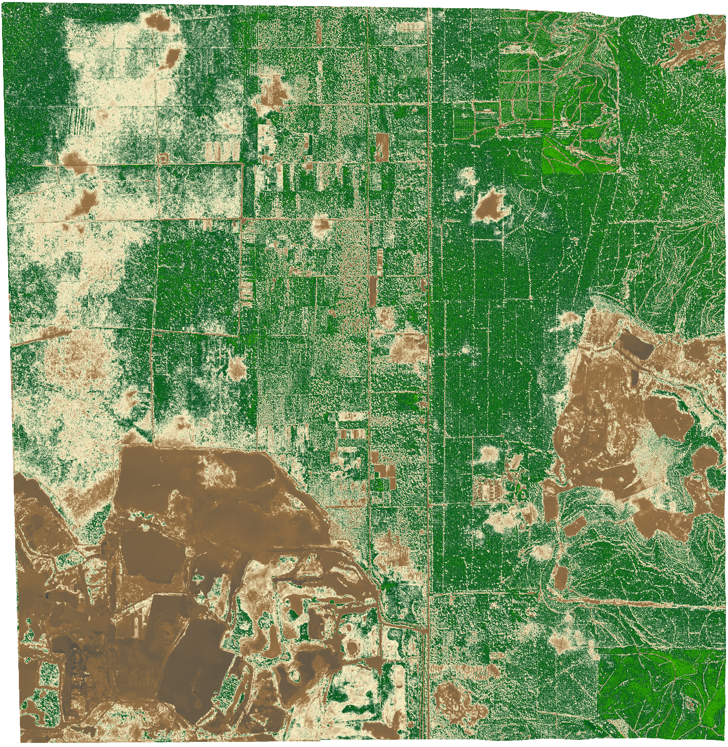
Vegetation health visualized using the Normalized Difference Vegetation Index, where greener areas indicate higher biomass and healthier plant growth.

NDVI Imagery

Vegetation health visualized using the Normalized Difference Vegetation Index, where greener areas indicate higher biomass and healthier plant growth.

NDVI analysis from multispectral satellite data is one of the most widely applied remote sensing products in precision agriculture, forestry management, and environmental monitoring. By quantifying the ratio of near-infrared to red band reflectance, NDVI maps reveal crop stress, deforestation patterns, pasture degradation, and seasonal vegetation cycles at scales ranging from individual farm fields to entire regional landscapes.

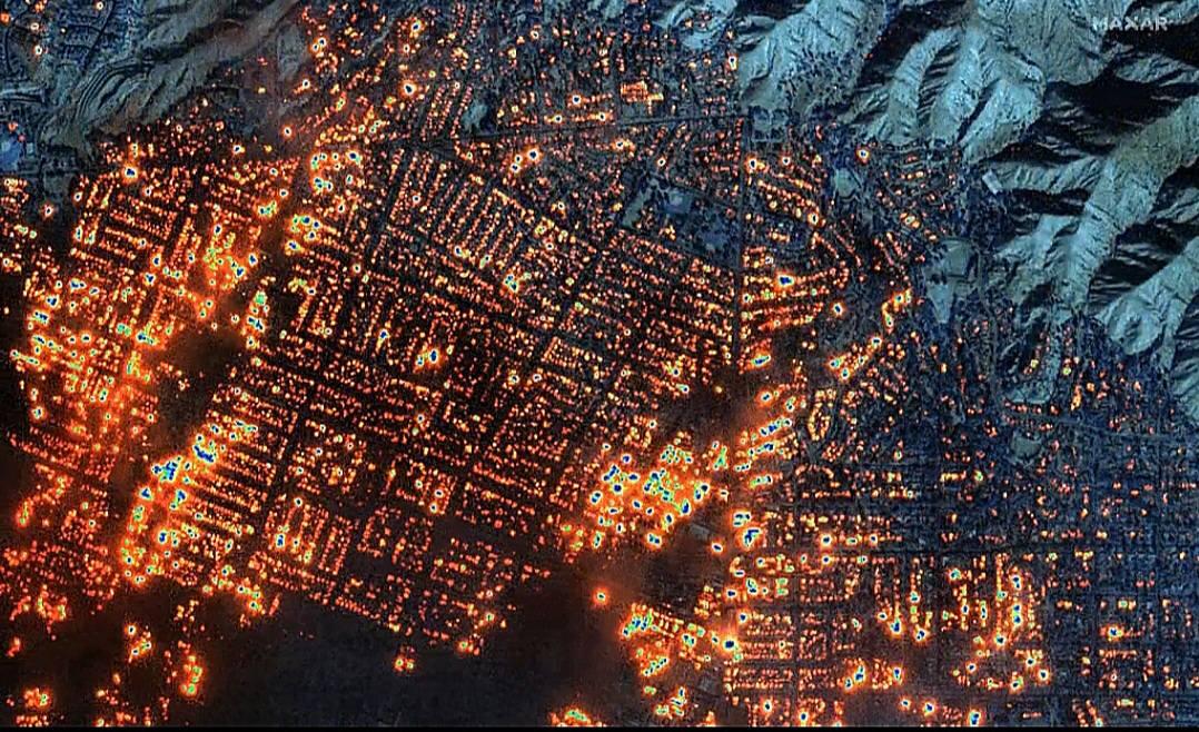
High-resolution satellite imagery from Maxar Technologies capturing widespread fire hotspots across an urban landscape, highlighting active burn zones and thermal intensity for rapid situational awareness and emergency response.

Thermal Satellite Imagery

High-resolution satellite imagery from Maxar Technologies capturing widespread fire hotspots across an urban landscape, highlighting active burn zones and thermal intensity for rapid situational awareness and emergency response.

Thermal satellite imagery captures radiated heat from the Earth's surface, detecting temperature anomalies invisible to optical sensors. Beyond fire and emergency response, thermal sensing supports industrial facility monitoring (detecting equipment heat signatures and energy loss), urban heat island mapping for climate resilience planning, and geothermal resource exploration.

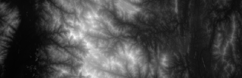
This image highlights ridge lines, valleys, and drainage patterns, providing useful data for watershed analysis, infrastructure planning, and environmental monitoring.

SRTM Elevation Data

This image highlights ridge lines, valleys, and drainage patterns, providing useful data for watershed analysis, infrastructure planning, and environmental monitoring.

SRTM (Shuttle Radar Topography Mission) data provides a near-global digital elevation model (DEM) derived from interferometric SAR data at 30-metre resolution. SRTM elevation data underpins a wide range of geospatial workflows including watershed delineation and hydrological modelling, slope and aspect analysis for infrastructure routing, flood inundation modelling, line-of-sight analysis for telecommunications, and terrain visualisation for environmental impact assessment and project planning.

image3

Land Cover Imagery

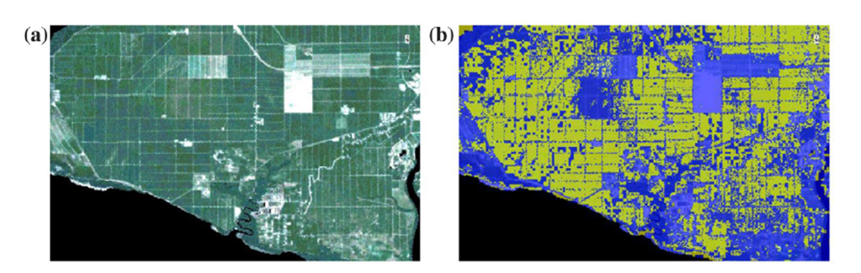
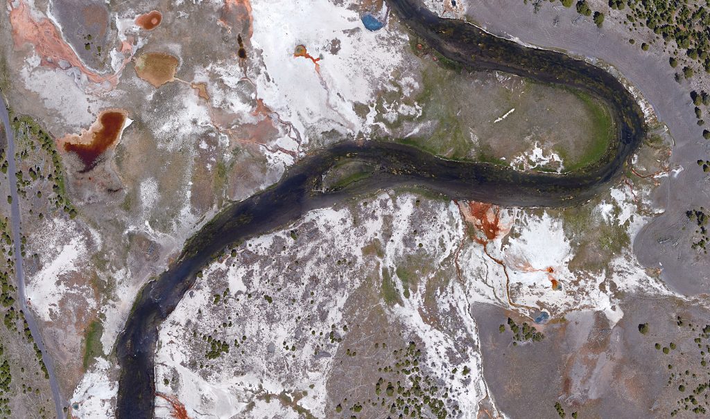
This satellite imagery reveals the diverse patterns of our landscape, from dense vegetation and agricultural zones to built-up urban areas,supporting smarter planning, environmental monitoring, and sustainable land management decisions.

Satellite Imagery Applications Across Industries

RedPlanet Solutions delivers satellite imagery services tailored to the specific analytical requirements of each sector, from raw image supply through to processed, analysis-ready geospatial products:

  • Agriculture and Plantation Management: NDVI and multispectral analysis for crop health monitoring, yield prediction, irrigation management, and oil palm estate management, covering areas too large for regular drone coverage.
  • Utilities and Energy: Thermal and optical monitoring of power line corridors, solar farm performance, pipeline right-of-way encroachments, and infrastructure condition assessment.
  • Environmental Monitoring and Compliance: Land cover change detection, deforestation monitoring, coastal erosion mapping, and habitat assessment for regulatory reporting and sustainability audits.
  • Urban Planning and Smart Cities: Land use mapping, urban expansion monitoring, building footprint extraction, and heat island analysis to support master planning and climate resilience strategies.
  • Infrastructure and Construction: Site progress monitoring, earthworks volumetrics, and flood risk assessment using high-resolution optical and DEM data from repeat satellite passes.
  • Defence and Emergency Management: SAR-based all-weather surveillance, disaster damage assessment, flood mapping, and vessel detection for maritime domain awareness.

Frequently Asked Questions

Satellite imagery refers to data and photographs captured by Earth-observation satellites orbiting between 300 and 600 miles above the surface. It includes optical (visible-light) images, multispectral data, thermal sensing, and SAR (radar) imagery — providing global coverage, historical archives, and spectral analysis capabilities that ground-based or drone surveys cannot match at scale.

Optical satellite imagery captures reflected sunlight in visible and infrared wavelengths, delivering photographic-quality images that require clear skies and daylight. SAR (Synthetic Aperture Radar) uses microwave pulses that penetrate clouds, smoke, and darkness, capturing imagery 24 hours a day, 7 days a week, in any weather. SAR is preferred for tropical environments, disaster response, and continuous monitoring applications where cloud cover makes optical imagery unreliable.

NDVI (Normalized Difference Vegetation Index) is a spectral index derived from multispectral satellite data that measures vegetation health and density by comparing near-infrared and red band reflectance. Healthy vegetation produces high NDVI values. It is widely used in agriculture for crop health assessment, in forestry for biomass estimation, and in environmental monitoring for land cover change detection.

High-resolution satellite imagery (sub-metre to 5-metre resolution) is used for asset identification, infrastructure inspection, construction progress monitoring, urban mapping, damage assessment, precision agriculture, and environmental compliance. Sub-metre imagery from platforms like Maxar WorldView-3 can resolve individual vehicles, building footprints, and structural features from orbit — providing the detail of aerial photography at global, repeatable scale.

SAR satellite imagery is used for flood mapping, land subsidence monitoring via InSAR, maritime vessel detection, forest change detection, agricultural crop monitoring, and disaster damage assessment. Because SAR acquires data through clouds, smoke, and at night, it is particularly valuable for tropical regions, emergency response, and any application requiring continuous temporal coverage regardless of weather conditions.

RedPlanet Solutions sources and delivers commercial satellite imagery from leading providers including Maxar Technologies — supplying optical, multispectral, thermal, and SAR data tailored to project requirements. Beyond image supply, RedPlanet processes and analyses satellite data into georeferenced GIS layers, NDVI maps, land cover classifications, DEM products, and change detection outputs, delivering analysis-ready intelligence rather than raw imagery.

SRTM (Shuttle Radar Topography Mission) is a near-global digital elevation model derived from interferometric SAR data at 30-metre resolution. It is used for watershed delineation, hydrological modelling, flood inundation analysis, infrastructure route planning, slope assessment, terrain visualisation, and line-of-sight analysis for telecommunications. Whether you need a single high-resolution image, a time-series archive for change detection, an NDVI analysis of your plantation estate, or SAR coverage through persistent cloud cover, RedPlanet Solutions sources, processes, and delivers satellite imagery products tailored to your requirements. Our team advises on the right sensor type, resolution, revisit frequency, and analytical product for your application, ensuring you receive analysis-ready intelligence, not just raw images. We source commercial satellite imagery from leading providers including Maxar Technologies and Planet Labs, and deliver processed outputs (georeferenced GIS layers, NDVI maps, land cover classifications, DEM products, and change detection analyses) directly into the workflows and platforms your team already uses, including Hexagon, SuperMap, and QGIS.

Access the Satellite Imagery Your Project Needs

Explore how RedPlanet can help your organisation solve its data challenges. Speak to our team today.