
Data Collection
RedPlanet Solutions provides geospatial data collection services for utilities, infrastructure, agriculture, environmental monitoring, and smart city projects.
RedPlanet Solutions provides geospatial data collection services for utilities, infrastructure, agriculture, environmental monitoring, and smart city projects.
OVERVIEW
Our services include drone surveys, mobile mapping, GNSS positioning, LiDAR scanning, thermal inspections, and multispectral data collection. These datasets support planning, inspections, monitoring, and asset management workflows across different operating environments.
Our drone survey, LiDAR mapping, multispectral, thermal, mobile mapping system (MMS), SLAM, and GNSS data collection services are deployed across utilities, infrastructure, agriculture, smart cities, and environmental monitoring. Each method is suited to specific environments and data requirements, from centimetre-accurate RTK GNSS surveys in the field to thermal UAV inspections of live electrical infrastructure.
WHAT WE OFFER
Drone data collection, also called UAV survey, uses unmanned aerial vehicles equipped with precision sensors to capture high-resolution spatial data across large or hard-to-access areas.
Compared to traditional ground surveys, drone surveys reduce field time and improve site coverage. The surveys generate datasets including orthomosaic maps, point clouds, thermal imagery, and multispectral analysis outputs.
We offer five specialist drone data collection methods, each suited to different data types and project requirements:
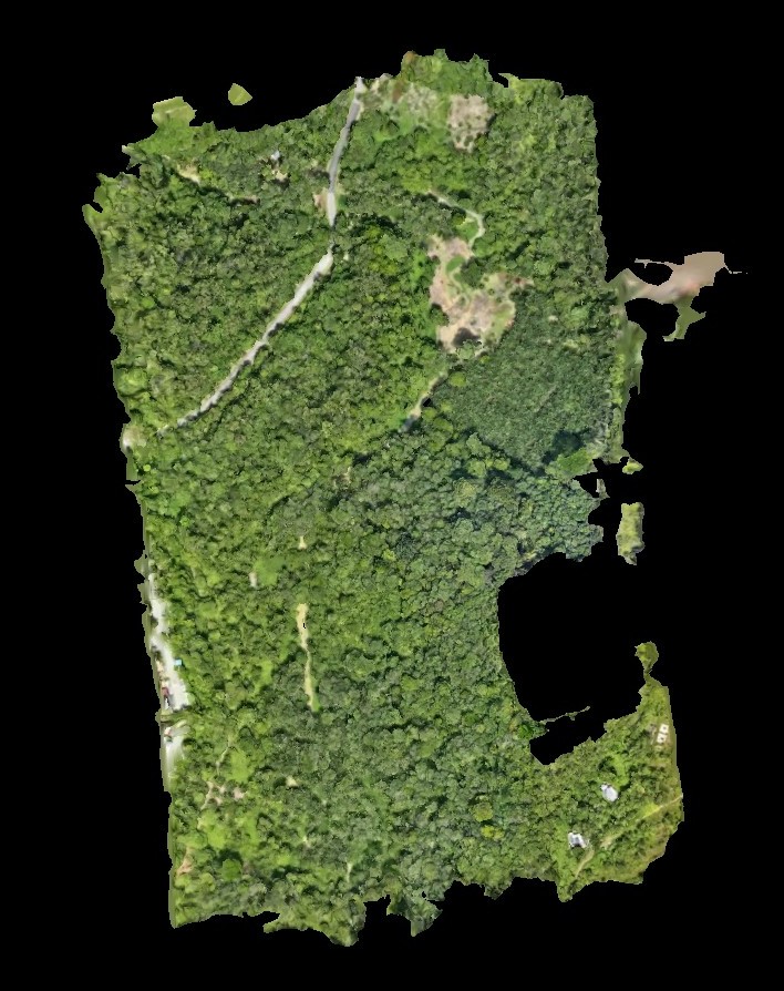
RGB drone data collection uses standard visible-spectrum cameras mounted on UAVs to capture high-resolution aerial photography for photogrammetric processing. The outputs include orthomosaic maps, digital surface models (DSM), 3D mesh models, and volume calculations. RGB surveys are used in construction progress monitoring, land titling, mining site volumetrics, and urban change detection. The result is accurate spatial records at a fraction of the cost and time of manned aircraft surveys.
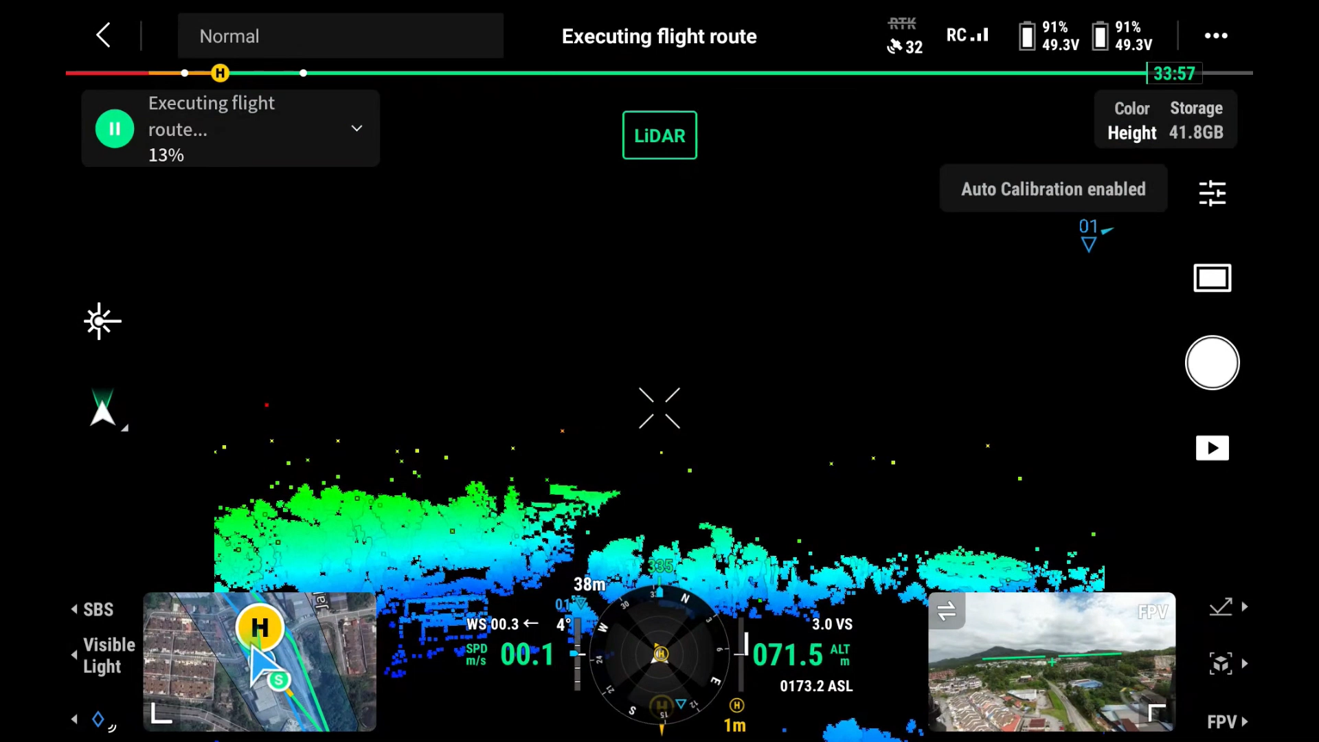
LiDAR (Light Detection and Ranging) is a remote sensing method that uses laser pulses to measure precise 3D distances to the ground surface, structures, and vegetation. Mounted on a drone, LiDAR sensors emit thousands of laser pulses every second and measure how long each pulse takes to return. The collected data generate dense 3D point clouds that can be processed into digital terrain models (DTM), digital surface models (DSM), and canopy height models.
Drone LiDAR surveys capture detailed terrain and structural data from above. Because laser pulses can penetrate vegetation, LiDAR is effective for mapping ground surfaces beneath tree cover where standard photogrammetry may struggle. Ideal for forestry, infrastructure, and environmental analysis, turn complex landscapes into actionable intelligence with speed and accuracy.
Drone LiDAR surveys produce point cloud data that feeds directly into GIS platforms, including GE Vernova Smallworld, Hexagon Geospatial, and Esri ArcGIS for asset management, infrastructure inspection, and network planning. Sub-canopy ground penetration makes LiDAR the preferred method for forestry inventories, flood modelling, powerline corridor surveys, and any terrain analysis where vegetation cover prevents photogrammetric accuracy.
Utility operators and forestry teams commonly use LiDAR in densely vegetated corridors where accurate terrain visibility is difficult to achieve using standard aerial imagery alone.
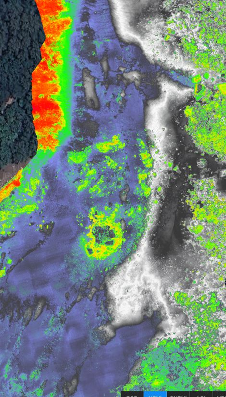
Multispectral drone surveys capture imagery across multiple spectral bands, including near-infrared (NIR) wavelengths not visible in standard aerial photography. The captured data is analysed using vegetation indices such as NDVI (Normalized Difference Vegetation Index) and NDRE to assess vegetation health, crop stress, irrigation performance, and land cover conditions.
Multispectral data collection is widely used in precision agriculture, forestry, and environmental monitoring. In agriculture, these surveys help identify irrigation issues, nutrient deficiencies, and crop stress before visible damage appears in the field. In forestry and environmental projects, the datasets support vegetation analysis, wetland mapping, and land management planning.
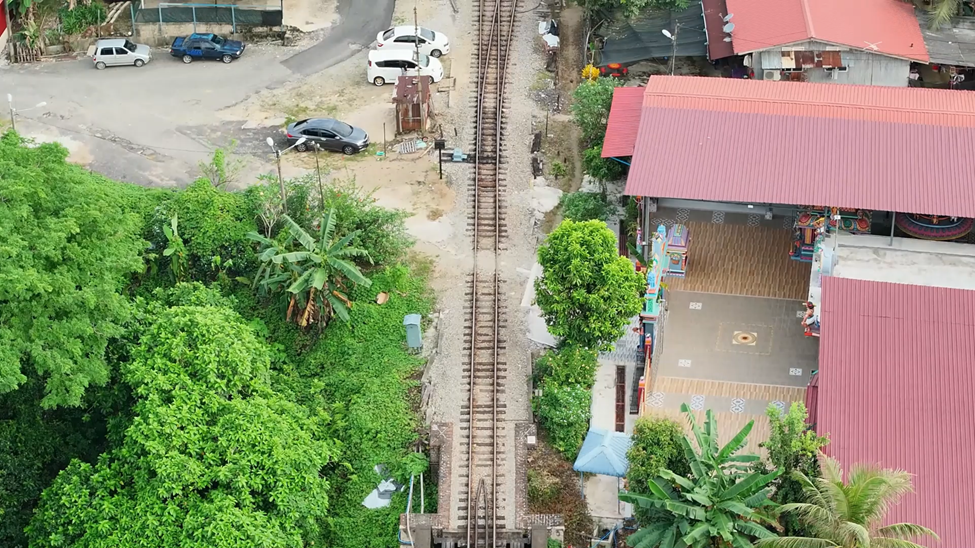
Drone monitoring helps organisations inspect infrastructure, equipment, and remote facilities without relying on manual access. Track, inspect, and manage critical assets in real time using advanced sensors and drone technology.
UAV-mounted cameras and sensors capture condition data for assets such as powerlines, pipelines, bridges, communication towers, and solar farms. The collected imagery supports maintenance planning, condition assessment, and inspection reporting.
Drone inspections are particularly useful for difficult access environments where scaffolding, shutdowns, or manual climbing would increase operational cost and safety risk.
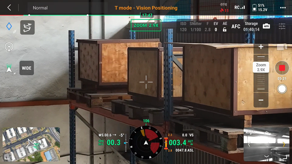
Transform warehouse operations with intelligent drone monitoring. From automated inventory tracking to real-time inspections of hard-to-reach areas, drones enhance visibility, reduce manual errors, and improve safety. Gain accurate data, streamline workflows, and keep your warehouse running at peak efficiency.
Automated drone monitoring in warehouses supports continuous inventory audits without interrupting operations. Drones follow predefined routes to scan barcodes and RFID tags across storage racks and distribution areas. The collected data updates inventory records more quickly than manual stock counting processes. Warehouse drone monitoring is commonly used in large logistics facilities where manual inventory checks are time-consuming and difficult to scale consistently.
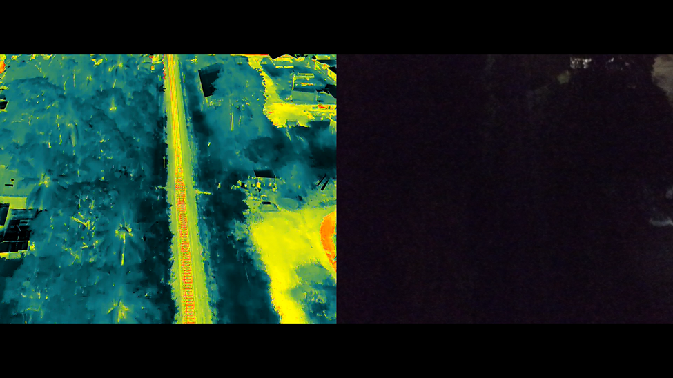
The technology is commonly used to identify overheating electrical components, insulation failures, equipment faults, and abnormal heat patterns across infrastructure and environmental sites. Thermal inspections allow maintenance and operations teams to assess large areas quickly without direct physical access to high-risk equipment or remote locations.
Key applications of thermal drone monitoring include:
Thermal drone monitoring uses infrared sensors to capture heat signatures and temperature differentials invisible to standard cameras. With 18,100 monthly searches globally, thermal UAV inspections are one of the fastest-growing applications in the geospatial data collection market.
In utility environments, thermal inspections are often performed during routine maintenance to identify failing components before outages or equipment damage occur.
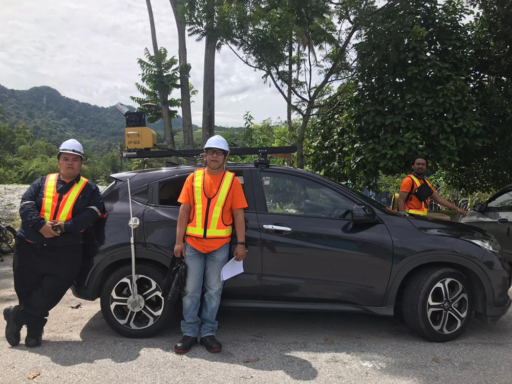
A Mobile Mapping System (MMS) combines LiDAR scanners, cameras, and GNSS/IMU positioning units on moving platforms such as vehicles, rail trolleys, or vessels. As the platform moves, the system continuously captures georeferenced imagery and 3D point cloud data across roads, rail corridors, utility routes, and urban environments.
MMS surveys are commonly used for road asset inventories, corridor mapping, pavement analysis, and digital twin projects where large coverage areas need to be captured efficiently. The dense 3D spatial data integrates into GIS platforms, including Hexagon Geospatial and SuperMap for asset management and infrastructure planning workflows.
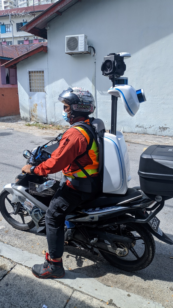
SLAM (Simultaneous Localisation and Mapping) is a technology that builds a 3D spatial map of an environment in real time while simultaneously tracking the sensor’s position within it, without relying on external GPS signals. This makes it the primary data collection method for environments where GPS is unavailable or unreliable.
Map complex environments with confidence using SLAM data collection. By simultaneously building maps and tracking position in real time, SLAM technology captures accurate spatial data in GPS-denied areas such as indoors, tunnels, and dense urban spaces. Move faster, reduce setup time, and unlock precise insights where traditional methods fall short.
SLAM data collection is commonly used for BIM documentation, facility mapping, underground utility surveys, and as-built verification in locations where tripod-based or satellite-dependent surveys are difficult to perform.
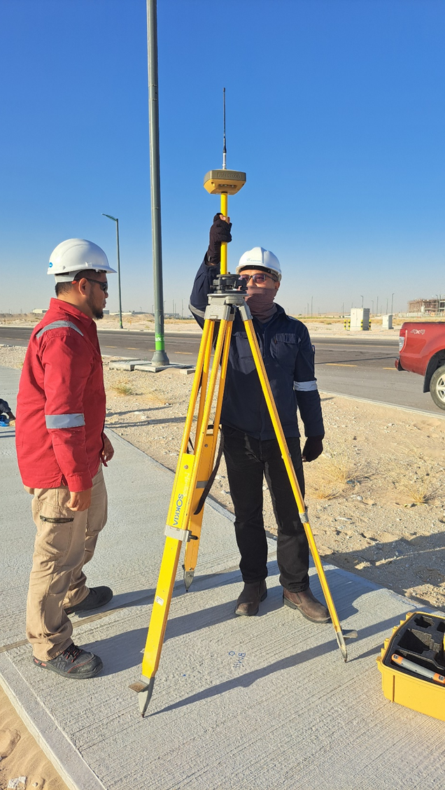
GNSS (Global Navigation Satellite System) data collection uses satellite constellations including GPS, GLONASS, Galileo, and BeiDou to establish precise geographic coordinates. When combined with RTK (Real-Time Kinematic) correction, GNSS achieves centimetre-level positioning accuracy in real time.
Achieve pinpoint accuracy with advanced GNSS data collection. Leveraging satellite positioning technology, capturing precise, reliable coordinates for mapping, surveying, and infrastructure projects. From field to finish, ensure consistency, efficiency, and confidence in every dataset.
RTK GNSS surveys support cadastral surveys, infrastructure setting-out, ground control point (GCP) establishment for drone photogrammetry projects, utility asset marking, and high-precision drone positioning for LiDAR and multispectral missions. Our GNSS field data integrates directly into GIS environments, including GE Vernova Smallworld for utility network asset management.
Our geospatial data collection services support projects across sectors where spatial accuracy and data quality directly affect safety, efficiency, and regulatory compliance:
RedPlanet Solutions offers drone surveys, including RGB, LiDAR, multispectral, thermal, and asset monitoring flights, as well as Mobile Mapping System (MMS), SLAM, and GNSS data collection services. Each method delivers precise geospatial data for utilities, infrastructure, agriculture, smart cities, and environmental monitoring applications.
LiDAR drone data collection uses laser pulses emitted from a UAV-mounted sensor to measure the distance to ground surfaces, vegetation, and structures with high precision. The result is a dense 3D point cloud dataset used to generate digital terrain models (DTM), digital surface models (DSM), and canopy height models for applications in forestry, infrastructure inspection, and flood modelling.
Thermal drone monitoring uses infrared cameras to detect heat signatures and temperature anomalies from the air. It is used for solar panel fault detection, building energy surveys, powerline and substation inspection, wildfire hotspot detection, and search and rescue operations, especially for applications where temperature differences indicate equipment faults, energy loss, or safety hazards invisible to standard cameras.
SLAM (Simultaneous Localisation and Mapping) data collection captures accurate 3D spatial data in environments where GPS is unavailable, including building interiors, tunnels, underground chambers, and dense urban areas. The technology builds a real-time map of the environment while tracking the sensor position within it, supporting BIM documentation, indoor navigation, and facility management.
A Mobile Mapping System mounts LiDAR scanners, cameras, and GNSS/IMU positioning units on a moving vehicle to capture continuous georeferenced 3D data as it travels. MMS surveys roads, rail corridors, and utility routes at driving speed, producing point clouds and imagery for road asset management, network planning, and smart city digital twin datasets.
Electric utilities, gas and water networks, telecommunications operators, local governments, construction and infrastructure firms, agricultural businesses, and environmental agencies all use geospatial data collection services. The specific methods used, such as drone survey, LiDAR, thermal, MMS, SLAM, or GNSS, depend on the environment, required accuracy, and the data outputs needed for each project.
Whether you need a single drone LiDAR survey, a thermal inspection programme, a mobile mapping run of a road network, or a complete multi-method geospatial data capture project, RedPlanet Solutions has the equipment, expertise, and experience to deliver.
Our teams operate across Malaysia, India, New Zealand, and the broader APAC region, supporting utility operators, government agencies, infrastructure developers, and agricultural organisations with field-ready data collection services.
Speak to us today!
Explore how RedPlanet can help your organisation solve its data challenges. Speak to our team today.