
Ensuring Reliability in GEV Smallworld GNM: The Role of Maintenance & Support
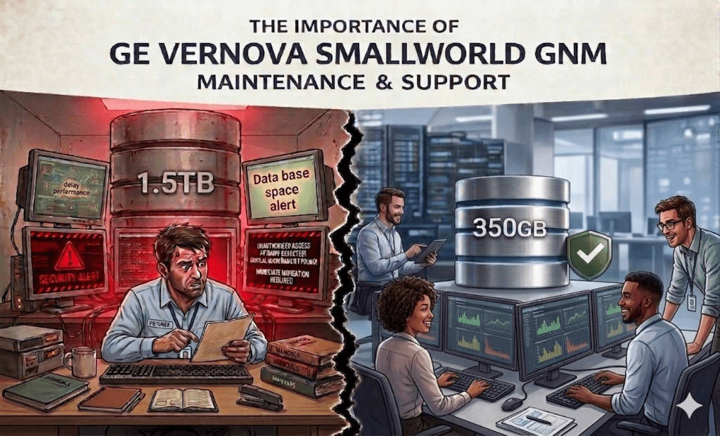
GEV Smallworld GNM Maintenance and Support Every GIS failure comes with a cost — delays, data inconsistencies, operational risks, and lost trust. In the world of geospatial network management, where precision and uptime are non-negotiable, a single point of failure can ripple across an entire organization. That’s why proactive, structured maintenance and support isn’t a […]
Revolutionizing Indoor Stock Inventory Monitoring with Drones
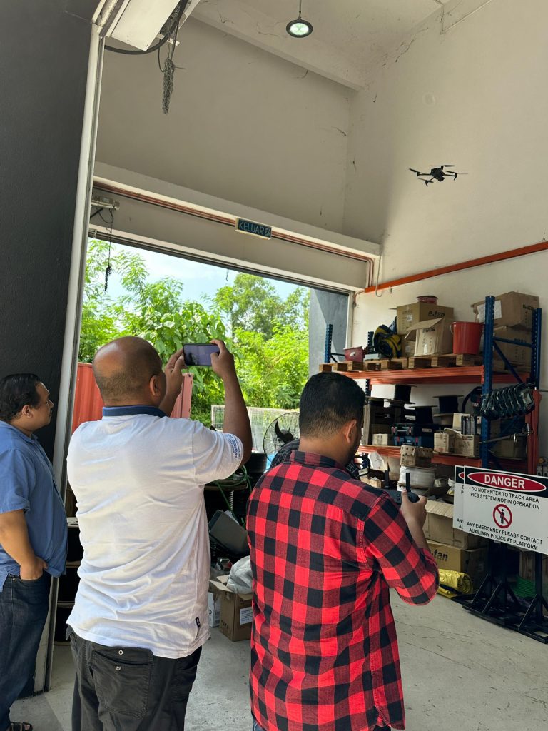
Drone Inventory Management for Warehouses Managing indoor inventory has always been a time-consuming and labour-intensive task — especially in large warehouses, factories, and storage facilities. Today, drone technology is transforming the way organizations track, audit, and manage their stock with greater accuracy and efficiency. Why Use Drones for Indoor Inventory Monitoring? ✔ Faster Stock AuditsDrones […]
Seagrass meadows are critical to coastal resilience — and managing them effectively starts with accurate data.
Seagrass Mapping with Drones and GIS Our Seagrass Mapping Solutions deliver high-precision spatial intelligence to help organizations monitor, protect, and manage coastal ecosystems with confidence. By combining drone surveys, remote sensing, and GIS analytics, we transform complex marine environments into clear, decision-ready insights. What you gain with our seagrass mapping services: • Accurate mapping of […]
Smarter Wildlife Dertection with Thermal drone Technology
Thermal Drone Wildlife Detection Detecting wildlife accurately — especially in dense vegetation, low visibility, or at night — is a major challenge for conservation and land management teams. Our Thermal Drone Wildlife Detection Solutions provide a faster, safer, and more reliable way to locate and monitor animals using thermal imaging combined with drone and GIS […]
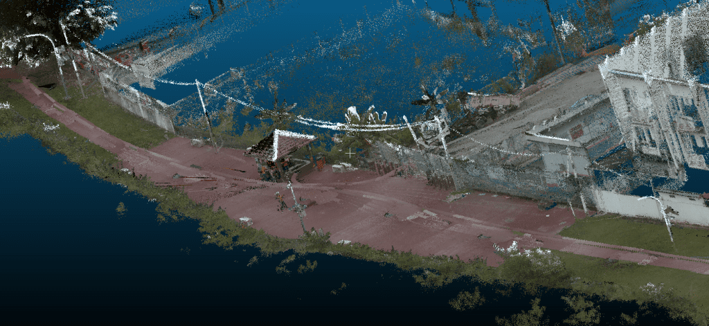
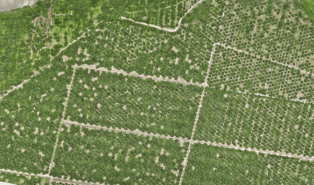
Unlock Plantation insights with LiDAR Technology
LiDAR Mapping for Oil Palm Plantations Managing an oil palm plantation efficiently requires accurate, reliable, and timely data — especially across large and complex terrains. Our LiDAR Mapping Solutions for Oil Palm Plantations deliver high-resolution 3D intelligence that transforms how plantations are monitored, planned, and optimized. By capturing detailed terrain and canopy data, LiDAR penetrates […]
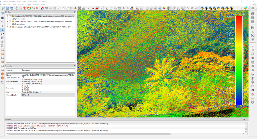
Reveal Vegetation Insights with High-Precision LiDAR Mapping
LiDAR Mapping for Vegetation Insights Understanding vegetation accurately — from canopy structure to ground conditions — is critical for effective land, environmental, and asset management. Our Vegetation LiDAR Solutions deliver high-resolution 3D data that penetrates vegetation layers to provide precise insights impossible to achieve with traditional imagery alone. Using advanced airborne and drone-based LiDAR, we […]
AI-Powered Digitizing & Analysis for Smarter Oil Palm Management
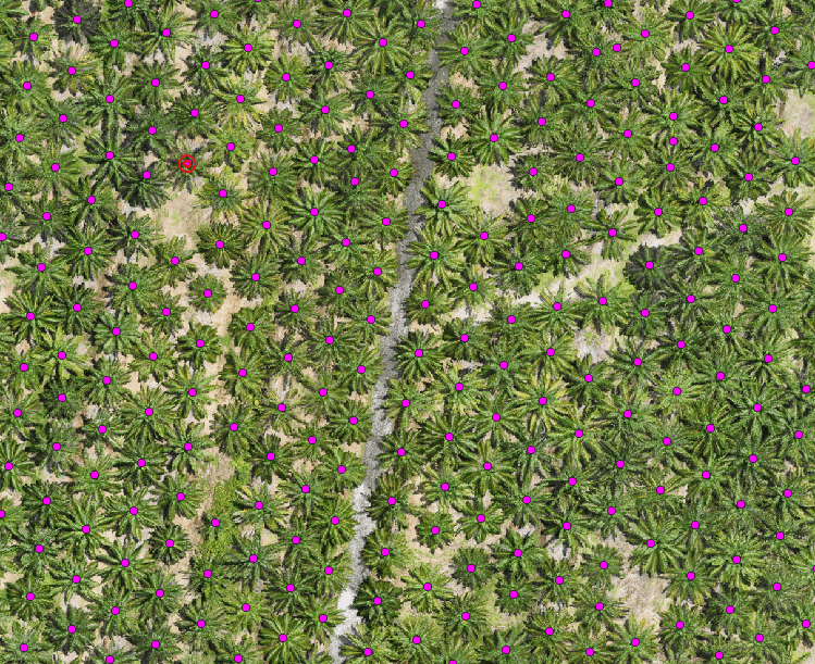
AI Oil Palm Management and Smart Digitizing Managing large-scale oil palm plantations demands clarity, accuracy, and speed — yet traditional mapping and reporting often fall short. Our AI-Driven Digitizing & Analysis Solutions for Oil Palm transform raw spatial data into an intelligent schematic display, giving plantation managers a clear, actionable view of their estates — […]
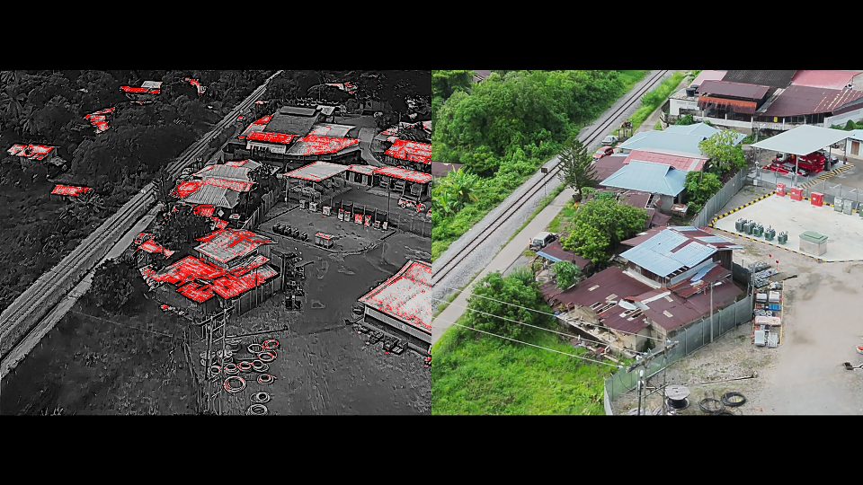
Early Fire Detection with Satellite Intelligence
Satellite Wildfire Detection and Fire Risk Wildfires and uncontrolled fires pose serious risks to people, assets, operations, and the environment — and early detection is critical to minimizing damage and response costs. Our Satellite-Based Fire Detection Solutions leverage high-frequency satellite imagery and AI-driven analytics to detect thermal anomalies and fire hotspots at an early stage […]
Automate Pole Inventory & Inspection with AI- Powered Pole Detection
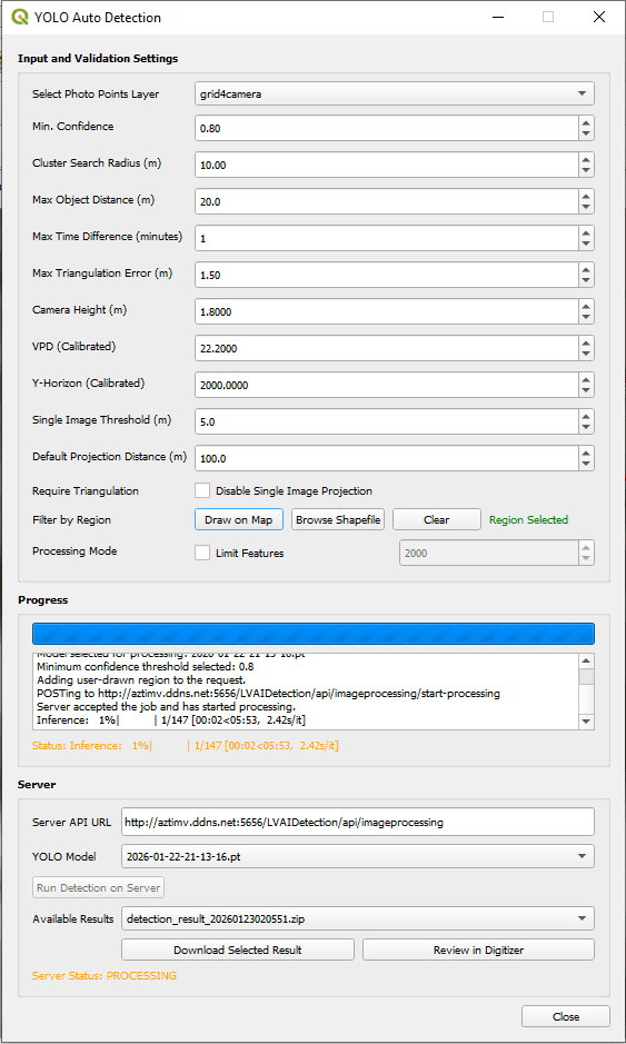
AI Utility Pole Inspection with LiDAR Managing thousands of utility poles across wide service areas is complex, time-consuming, and costly when done manually. Our AI-Powered Pole Detection Solution uses LiDAR, street-level imagery, and advanced AI analytics to automatically detect, classify, and map utility poles with high positional accuracy — transforming pole management into a fast, […]
Transform Oil Palm Management with GeoAI Intelligent
GeoAI for Precision Agriculture in Oil Palm Managing oil palm plantations at scale requires more than maps — it demands intelligence that turns geospatial data into real operational value. Our GeoAI Solutions for Oil Palm Plantations combine artificial intelligence, geospatial analytics, LiDAR, drone imagery, and GIS to automatically extract insights that help plantation teams optimize […]