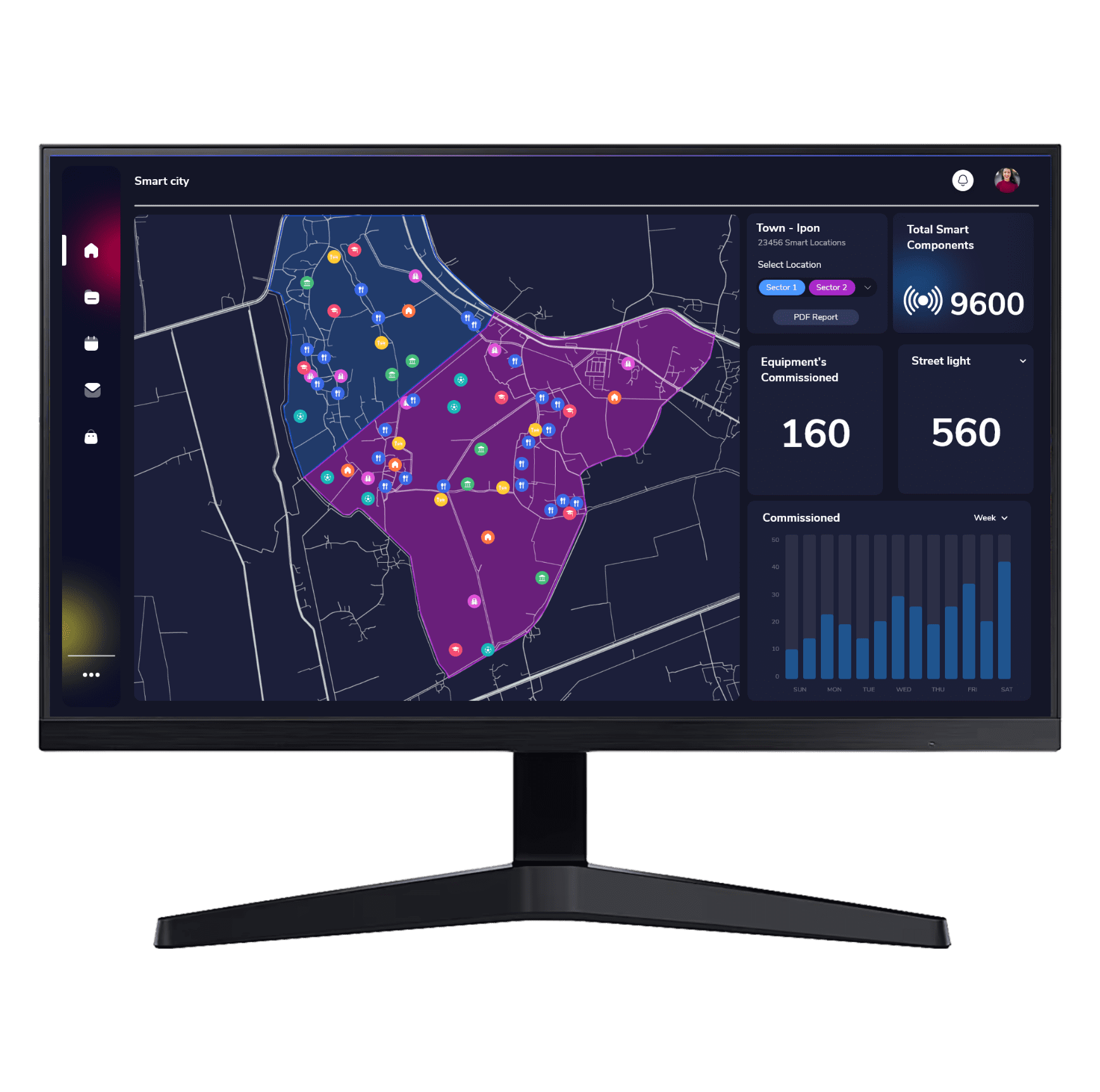
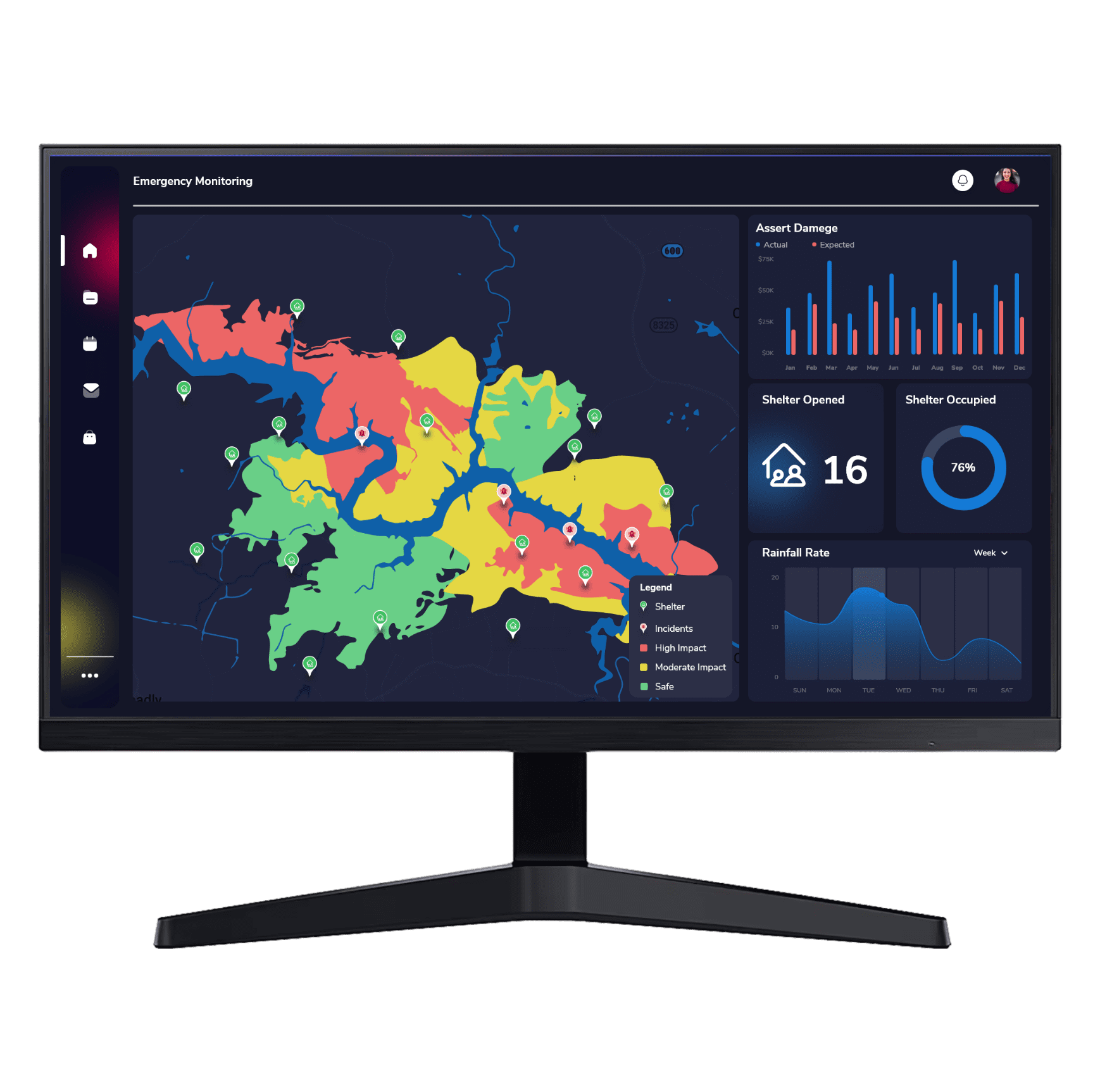
A real-time digital replica of an object in the physical world at the tip of your finger. Geospatial Digital Twin helps entities to visualize, predict, analyze and forecast what’s happening in real world.
GEOSPATIAL digital twin
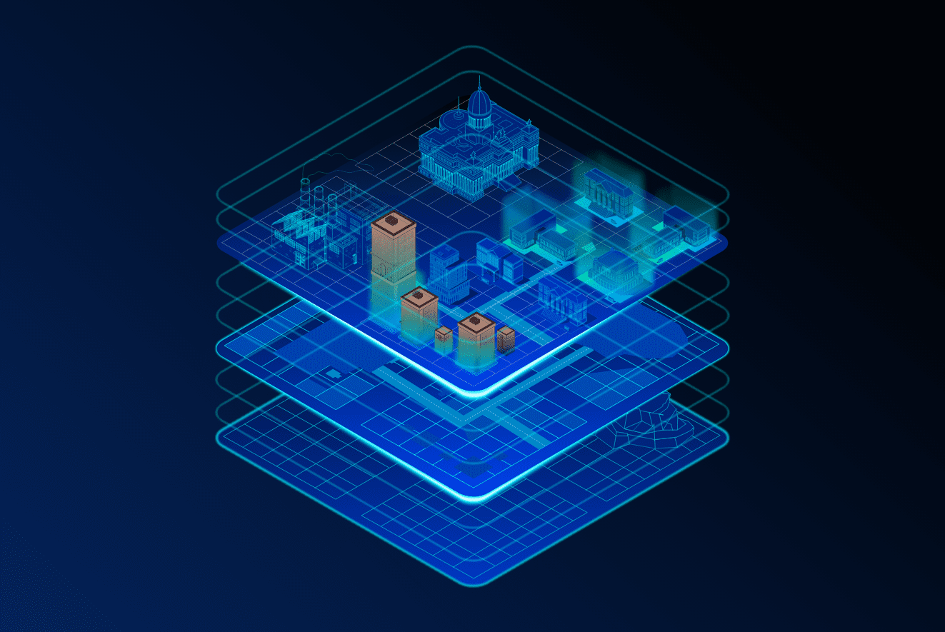
Having a virtual representation of the real world, with its natural and built environments, gives an insight to how the physical objects interact and process. GIS enables us to replicate not only the objects, but also the relationships, behaviors and processes in them. Bringing together the different types of data to a single view in GIS gives way for advanced analysis and automation of real-world processes.
Have building layer and elevation in perspective view (corner towards user) on left side. Have another layer like structure next to it on right side (initially blank). Have shiny jumpy lines between the two layers, slowly replicating to on right side
Realistic Modelling using CAD and BIM flavours up the GIS system. Connectors and Data Translators aid in seamless integration. GIS brings in additional layer of intelligence into the BIM layers.
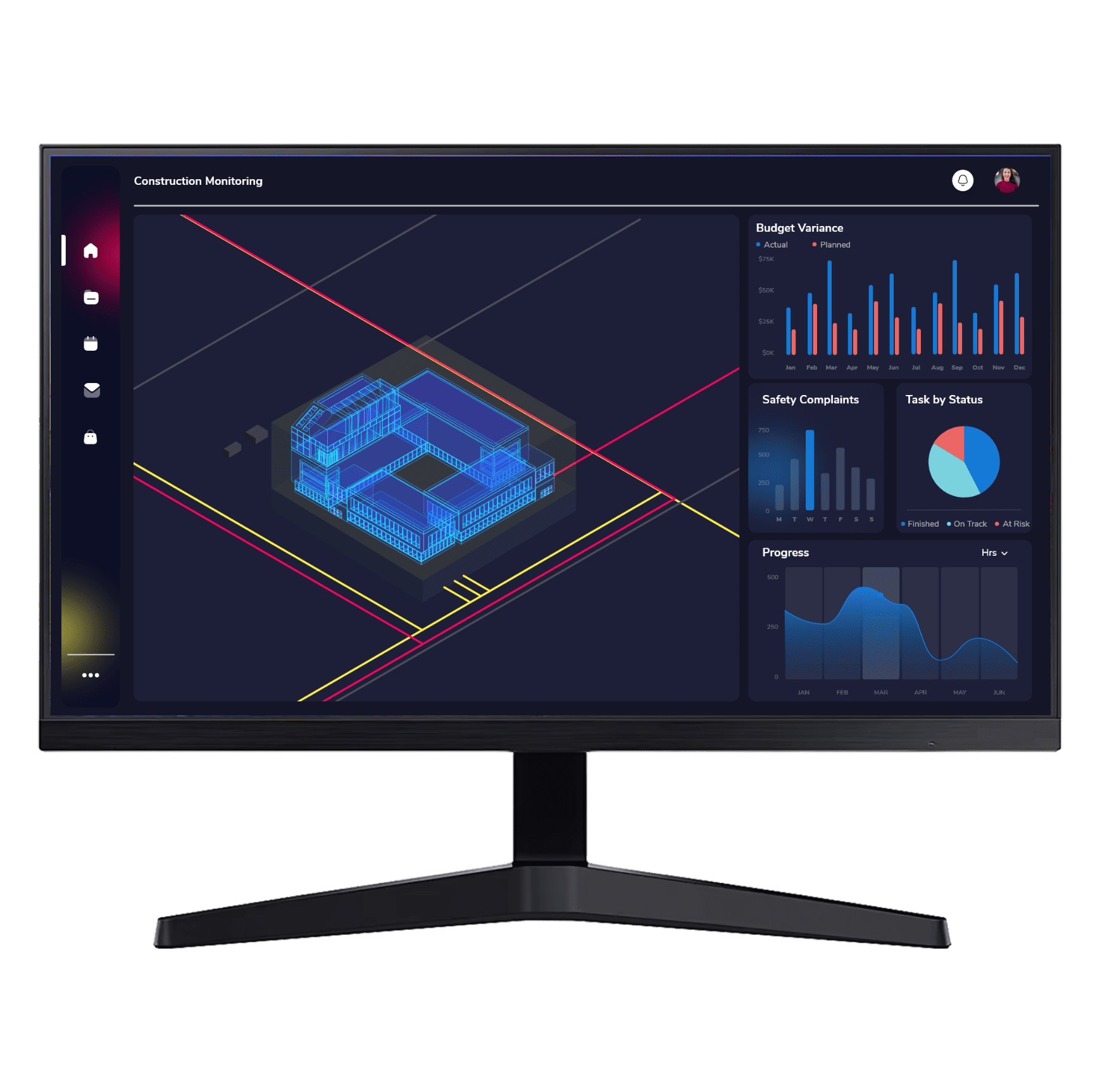
Real time integration & visualization
GIS+BIM is the go to tool as modern Construction warrants, near real time data visualization for a precise level of detailing with Simulation and Prediction with realistic Geospatial modelling.
Dynamic Sharing and collaboration
Across organization sharing of BIM models through secured cloud/on-premise platforms has become hassle free. Interconnected platform becomes one-stop solution for any management.
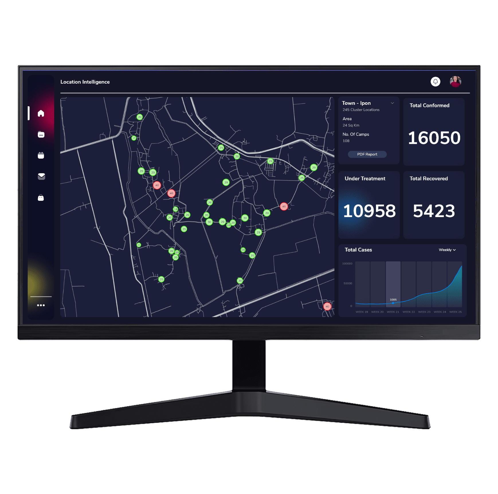
Explore how GIS can help your organization solve industrial challenges. We expand more potential on your industrial data that you have within your reach.