GeoAI: Combining Geospatial Technology and Artificial Intelligence
Converting data into meaningful analysis to help solve your business challenges and predict trends to improve your processes
What we do
geo ai
The combination technology of artificial intelligence (Al) and GIS (geographic information systems) dimension creates geospatial artificial intelligence (Geo-Al). Geo-Al applications also can be used Agriculture, Road Maintenance, Traffic Monitoring, Utility and Construction. GeoAl technologies can capture and model our environment, linking the places, time to environmental, social, and other types of location-specific exposures, to explore their potential roles.
solutions
Uncover Hidden Patterns, Automate Business Process
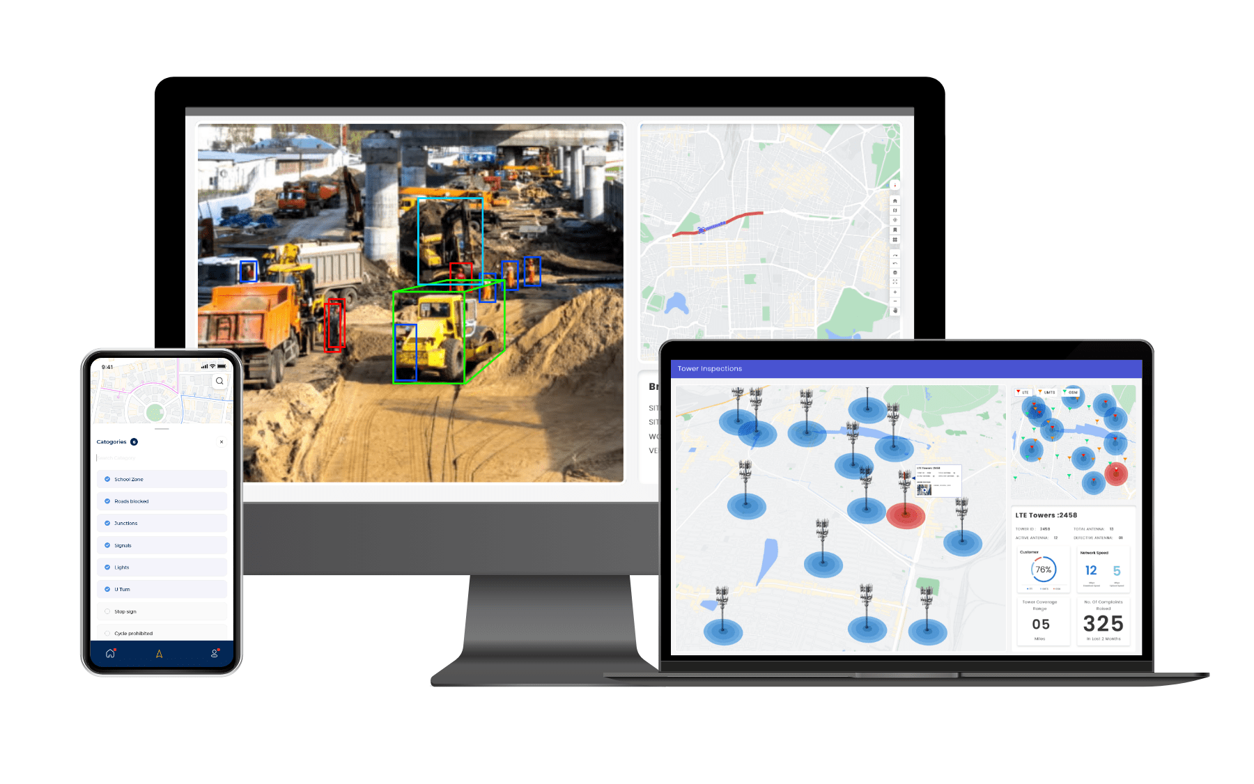
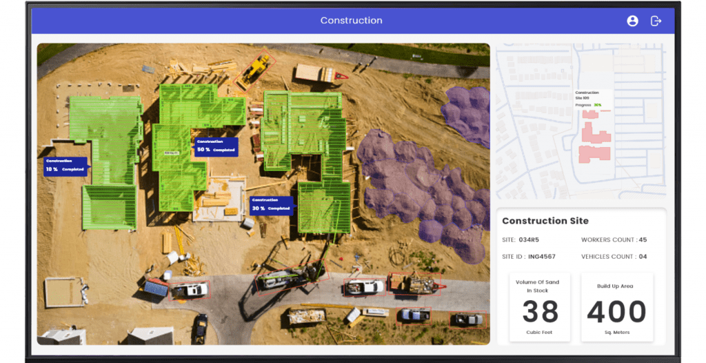
Engineering & Construction (E&C)
Road & Asset
Agriculture
Tower Inspections
Engineering & Construction (E&C)
Stackeholders across the project lifecycle including contractors, operators, owners, and service providers, can no longer afford to conceive of AI as technology thats pertinent only to others industries.
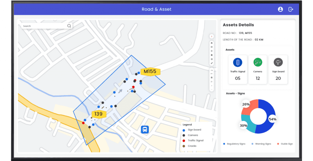
Road & Asset
There’s a new way to look out for fractures and potholes in the road. And, it doesn’t need eyes to see them. Deep learning algorithms can evaluate cracks, fractures, and other road damage to predict whether a road need small fixes or a major overhaul.
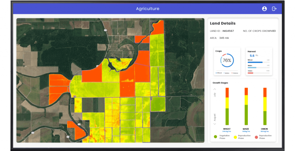
Agriculture
Efficient centric management demand real time information to drive the growth of agriculture market. They use deep-learning algorithms to process data captured by drones and/or software-based technology to monitor crop and soil health.
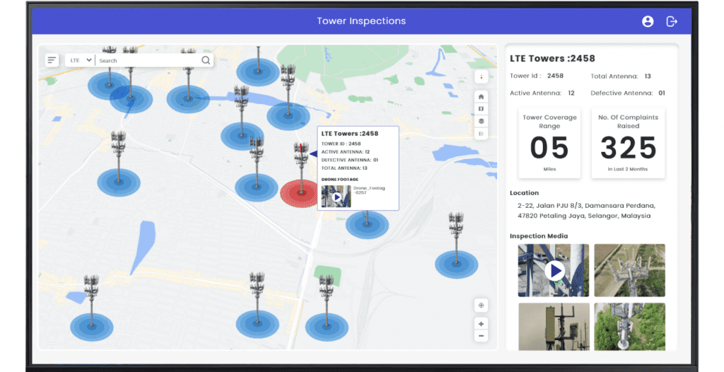
Tower inspections
A vision application using GeoAl can improve tower inspections with accurate insight.
Structural reservation
Locate defects
Assembly errors
Vegetation overgrowth
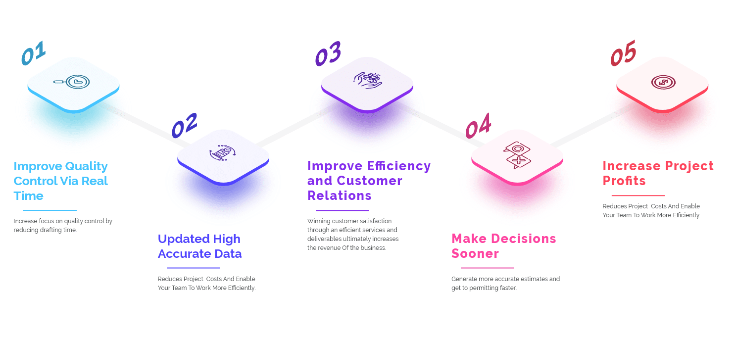
benefits
Geo-Artificial Intelligence
Speak to us today!
Explore how GIS can help your organization solve industrial challenges. We expand more potential on your industrial data that you have within your reach.